William Hack and the Description of New England
By Richard Boulind
INTRODUCTION
THE painted manuscript map of seventeenth-century New England by William Hack that is at Pilgrim Hall, Plymouth, has been a prized possession of the Pilgrim Society since it was acquired from England at the turn of the twentieth century. But until 1975 no attempt to make a worthy reproduction or undertake a serious study of it met any success. To achieve the first part of this aim the Meriden Gravure Company of Meriden, Connecticut, employed the care and devotion that are customary with it to execute a facsimile.
The study printed here has been written to accomplish the second part of it. It sets out unblushingly to take advantage of much that has been discovered by scholars within the last few years about the maker of the Plymouth map and the methods that were required to make it. Even though many discoveries no doubt remain to be made, a great wealth of data has been plucked from those archives and map libraries so far searched in the endeavor to illuminate the cartography of the seventeenth century. For the most part, however, these data have still to appear in print, at least in any definitive form. Though some superficial cataloguing of the work of Hack and his contemporaries, and of early maps of New England has been done, there are probably many more materials to be discovered. Many attributions of what is already known have yet to be made or corrected. As yet, for instance, there is no connected biography of William Hack or listing of all his known work. There is no reliable directory of contemporary mapmakers and no authoritative catalogue of their products. Many significant advances towards a history of the important so-called “Thames School” of English manuscript cartography have recently been made, but have so far appeared in print only in scattered and disparate forms. The essential critical and comprehensive study of it still awaits an author. Again, in his recent masterly survey, British Maps of Colonial America, Professor William P. Cumming notes regretfully that “one of the chief desiderata in the cartobibliography of colonial North America is a study of the New England region.”
To the extent that these desirable scholarly works were prerequisite for an adequate study of the Hack map at Plymouth, I have therefore had to supply them. To construct these indispensable preliminaries I have been more dependent than I would otherwise have been on the help of others. For their unremitting but considerate zeal to have the Plymouth map adequately noticed in print at last, recognition must be given to the officers of the Pilgrim and the Colonial Societies. Mr. Lawrence D. Geller, former Director of the Pilgrim Society, also ensured that I had every access to the map and to associated materials, whether it was convenient for the Society or not. The late Dr. Walter Muir Whitehill, at the time Editor of the Colonial Society of Massachusetts, in addition made it possible for me to have unrestrained use of accurate photostatic copies of unique maps in European collections that were needed for comparative study. I am grateful for this assistance and encouragement. I also pay tribute to the sympathetic advice of Mr. Tony Campbell, a much earlier searcher for the truth about Hack, who generously added his unpublished researches to those already in print for me to use. For advice on American Indian names and related topography that I could not otherwise have secured I am extremely grateful to Miss Denise Wilcox, and for other enlightenment in general I thank Miss Jeannette Black, Professor Thomas R. Smith and Professor William P. Cumming. For critical care to produce a respectable typescript from the intricacies, and sometimes errors, of the writer’s text and references, I have Susan Danforth to thank. Naturally, none of the scholars named are responsible for any misuse of their help or for any errors that may remain in what I have written.

One of the most striking maps to be seen in America is the Pilgrim Society’s Description of New England in America. It shows New England in the first century of its colonial existence. The province mapped here is that settled principally by the Pilgrims of 1620 and their immediate successors, the men and women of the Great Migration of the 1630’s. Nonetheless, it displays the extent and the variety of the Indian culture on the ancestral ground it held up to the time of King Philip’s War, about which the map gives hints. This venerable map, on crackled vellum, is usually on display at Pilgrim Hall, Plymouth, Massachusetts. It is a document whose origin is even more mysterious than the exact features on its now time-clouded face. One like it was what Nathaniel Hawthorne had in mind, describing in the Colonel’s study “a map of the Pyncheon territory at the eastward, not engraved, but the handiwork of some skilful old draftsman, and grotesquely illuminated with pictures of Indians and wild beasts, among which was seen a lion; the natural history of the region being as little known as its geography, which was put down most fantastically awry.”1
Despite its great age, the map has been at Plymouth only since the turn of this century. It is not physically a relic of the Colony of New Plymouth that is on view. Instead, the map is an artifact of old England, by an English cartographer who quite possibly, even probably, never himself saw New England. It spent almost exactly two centuries in English collections before it appropriately entered the ownership of the Society that commemorates the oldest colony in New England. The map is a manuscript of a very puzzling sort. Yet it does have cousins among surviving maps of New England: one can suggest maps that now, seemingly, are lost which could have been its parents. William Hack’s map at Plymouth is indisputably of a seventeenth-century type and date. But on close inspection, it seems less old than two maps that are better known because they were printed—one of them the first in America. The Plymouth map, however, excels in the rich spectacle it displays and in the importance of the patron for whom it was made. It is immensely wealthy in topographical reference: not until another half-century passed did any map of New England record more place-names.
The map proclaims itself the work of William Hack—“Gulielmus” in Latin. His biography is very obscure, and little is known about him save what can be deduced from his work.2 However, he was clearly an Englishman working in London in the last third of the seventeenth century. He must have worked hard. His main business was to draw and sell practical maps in quantity, both of the land areas and of seas interesting to Great Britain’s expanding colonal empire and international trade. Hack was adventurous in searching out new maps and journals to edit; he is famous for mapping the western coasts of the Americas, of which he made several manuscript atlases that survive in English and American libraries. But he compiled atlases of other areas: in the one of America’s eastern coast are several maps of New England that strongly resemble his map at Plymouth. He also compiled the narratives of explorers and buccaneers; besides editing supplements to Esquemeling’s Buccaneers of America, he published voyages and maps in a collection of his own, as well as two separate printed maps. He also drew some separate charts, of which the Description of New England at Pilgrim Hall is the most significant.
The map at Pilgrim Hall
As it is now to be seen at Plymouth, the map is complete, and entirely original. It is on a single piece of vellum. Its overall dimensions are 26½ʺ × 32⅛ʺ (66.2 × 81.5 cm.), but the material has warped, or been trimmed, unevenly, and on an average measures approximately 25⅞ʺ × 31⅞ʺ (65.0 × 80.6 cm.). The vellum of the Plymouth map is an exceptionally large single sheet; the size implies that the material is not the sheep (or goat) skin more commonly employed, but calfskin—vellum in the strictest sense. When the facsimile was prepared, the map was slightly reduced to a more convenient size corresponding to 21¾ʺ × 27ʺ (55.4 × 68.6 cm.) over its maximum dimensions. So slight a reduction leaves the map’s impressive aspect and its clarity unimpaired, but the change should be borne in mind if this map is being considered alongside others.
In its present state the map exhibits the whole of one face of the vellum. Modern remounting has exposed marginal areas that once were folded and fastened down over the backing even though they are part of the delineation, which the cartographer took to the very edge of the vellum. A slightly blurred near-straight edge along the inner face of the map’s double-line border can be discerned by a careful eye, and so can rows of dark dots from the pinholes and the discoloration around them: both are explained by this early folding on to boards. In the seventeenth century it was the custom so to mount a map, to preserve it from excessive handling and to display it for ready reference. Maps like the Plymouth one, but intended to be used by pilots at sea, it has been noted, were “usually mounted on two or four hinged oak boards so that they could be folded up like a book or screen to protect the surface when not in use.”3 The New York Public Library has a remarkable map of North Carolina drawn in 1657 by Nicholas Comberford that is still mounted exactly this way.4
The map at Plymouth, however, was a map covering a wide area of colonial territory, not a sea chart, and was probably kept displayed for consultation in a study or office. In a council chamber or office a map hung up would eventually be darkened by candle and tobacco smoke, especially if it were varnished, as some maps apparently were. Indeed, a map might suffer the personal impress of spectators, calling to mind Hawthorne’s other description, of the “large map, or surveyor’s plan, of a tract of land, which looked as if it had been drawn a good many years ago, and was now dingy with smoke and soiled, here and there, with the touch of fingers.”5
Complex processes of photographic separation and offset lithography have achieved a reproduction that is faithful to the colors of the original and accurately renders every feature and legend marked upon it. As all temptations to retouch the image were resisted, a few stains remain in the reproduction, but are easily detected: there is a small sequence of rust marks on western Connecticut and Long Island Sound and a single blotch, perhaps caused by water, on Vermont. A certain amount of speckling and rubbing can be seen on the original—most obviously on Long Island—and has, likewise, not been hidden. There is a certain greyness in such areas as the extreme top and the Nantucket area at lower right which comes through, too: this is due to a chronic dampness which produced mildew on the map before the Pilgrim Society called in art restorers. They took conservative action in which the spread of deterioration was arrested and the condition of the vellum and inks stabilized. Almost every feature to be detected on the map still shows up, to some degree, to the naked eye, though the red paint used for some legends seems to have suffered more than the black ink of most of the place-names (which has merely aged to grey-brown) or the green and yellow hues providing the decoration. Thus the present balance of colors is probably somewhat different from what Hack intended. Nonetheless, one apparent defect is not, in any event, the result of deterioration: the curiously indistinct coastline from the Connecticut River round Narragansett Bay and Cape Cod almost to Boston harbor is so because, for some reason, the mapmaker left it uncolored in the first place.
No apparent mention of this map of New England has survived from the lifetimes of the mapmaker or of the first owner, the dedicatee. Sir Walter Yonge’s last male descendant was his grandson Sir George, the fifth baronet (1731–1812); he married an heiress who conveyed to him a mansion at Foot’s Cray, Kent. If the map now at Plymouth remained in family hands and became part of the furnishings when it was outdated for use, as seems most likely, this house might have been its resting place. More probably, it was taken to the West Country, to the manor house of Escot at Honiton or to the ancestral home at Colyton: in the latter case, when Sir George died without direct heirs in 1812, it could have passed to Sir John De La Pole, Bart., to whom Sir George conveyed the house.6
Lost to view for most of the eighteenth and nineteenth centuries, the map could not be readily assessed when it was offered for sale in England in 1897, by a vendor named only as “J. Piper.” According to a note at the Pilgrim Society, the map was originally purchased from a lady resident in Gloucestershire (England), who stated that it had been in her family “more than 100 years.” If so, she may have been a relative of the dedicatee’s family. Possibly the map changed hands only once between 1700 and 1897. The map’s provenance from the same English county as another great collection of manuscript maps of the North American colonies—the Blathwayt Atlas, preserved by the first owner’s family at Dyrham Park for two hundred years till the John Carter Brown Library acquired it in 1911—seems a complete coincidence. There is nothing to show that this map of New England passed through the hands of William Blathwayt, notwithstanding its remarkable congruence with his maps.
The Pilgrim Society received the map at Plymouth only in 1903—the year it was first described in the press, as a recent acquisition. A report on William Hack was in the same year obtained from the Library of Congress, Washington. The report, dealing with Hack as author of the Library of Congress’ manuscript atlas of the East Indies by him, was the work of Frederick C. Hicks, a subordinate of P. Lee Phillips in the Map Division.7 Though the Pilgrim Society has kept Hack’s map on exhibition at Plymouth for several decades, other references to it in learned literature have been few and far between. Only two need be cited. The map was incidentally, and rather misleadingly noticed, by I N. Phelps Stokes, the voracious collector of maps and prints of northeastern America which are in the New York Public Library, and indefatigable compiler and writer of the great six volumes based on the collection.8 Perceptive commentary has most recently been given to the Description of New England in the context of its relationship to contemporary maps, in an accurate note by Miss Jeannette D. Black, curator emeritus of maps at the John Carter Brown Library.9
Sir Walter Yonge, Bt., patron, and customer for the map
The mapmaker’s own signature apart, the map’s most striking inscription is the dedication placed boldly at upper left. Noble and ornamental, it also provides us with the map’s title. The arms are those of Sir Walter Yonge, 3rd Baronet (circa 1653–1731). Simply described, they consist of a shield divided horizontally into a black upper, and a white lower half, respectively bearing two lions and one, in countercharged white and black; the lions are drawn walking on their hind paws, their faces turned toward the spectator. As often happens with heraldry applied derivatively like this, this armorial achievement is considerably different from the one registered at the College of Heralds for the Yonge family, which is defined as “Argent on a chief gules three lions rampant guardant of the first.”1 However, the crest is the helm conventional for a baronet’s arms, though much faded on the map; the whole is superimposed on ornamental foliage, now indistinct. Below it is boldly drawn a garland containing the prominent dedication of “this description of New England in America” to “The Honourable Sr. Walter Younge Barronet—One of the Commissioners for His Maiesties Customs . . . ,” again signed by Hack with his name.
There is nothing but this dedication to define or date the map precisely. The vague inferences we can draw from its basic cartography and its roll-call of place-names are delusive here, as the general error of supposing that they date the map to 1663 shows. Such evidence as this is insufficient to fix the actual drawing of this particular map, specially as it does not fit what is known about the career of William Hack. The best evidence, though, lies in the dedication: if read correctly, its wording even tells us that Hack drew the map between 28 December 1694 and 14 November 1701. In every other respect, profound silence enfolds the map’s origins. This demands that we examine who Hack’s patron was.
The Yonges were an important family of West Country gentry, some of whose mediaeval ancestors had been chief magistrates of either London or Bristol. In the seventeenth century, however, their seat was at Colyton in eastern Devonshire. They owned property in the market town of Honiton nearby and they were allied by marriage to such other county families as the Drakes of Ash, related to Sir Francis Drake. In the 1650’s, during Cromwell’s rule, John—the grandfather of Sir Walter Yonge—joined Sir Anthony Ashley Cooper (later to be first Earl of Shaftesbury and the founder of Carolina) in opposing the Protector, and in 1661 he was rewarded with a baronetcy by the newly restored King Charles II. Sir John, and his son Sir Walter, the second baronet, both died within a few years.2 Hack’s eventual patron succeeded to the title in 1670, the same year he matriculated—at the age of 16—at Exeter College, Oxford.3 He seems not to have taken any degree there, so the next public record of him is as Member of Parliament, in the family seat at Honiton. Politically, Honiton was accounted a venal and “democratic” borough, with a large franchise vested in the whole number of the householders paying the property tax. By one of those tacit understandings common in the unreformed House of Commons, the Yonges shared influence there with the even older Courtenay family which was Royalist, and later Tory, in politics.4
Sir Walter Yonge was evidently an enemy of the absolutist policies that Charles II and James II followed for the next eight years.5 During them, Stuart despotism called in the charters of the cities of England and of the colonies in America. In 1686 James II created the Dominion of New England, which combined the New England colonies with New York and New Jersey under the rule of one royal Governor-General in Boston (the sole memorial to the Dominion is the amalgamation of the Plymouth Colony with Massachusetts Bay, which then took place). Yonge was absent from the sole parliament of the period, though in May 1686 King James did appoint him Deputy Lieutenant of Devon, a usual position for the family’s head to hold. However, early in 1685, many Colyton people joined the uprising against James II led by his bastard nephew, the Duke of Monmouth: Yonge had been regarded as suspect, and was himself arrested for “dangerous and seditious practices” at the time of the king’s coronation.6
Sir Walter Yonge stood to gain greatly by the Glorious Revolution of 1688, which began when the Prince of Orange, invited from Holland, landed in his own county of Devon. When William III and his wife, James II’s daughter Mary, were invited to take the crown jointly by the Convention of 1689–1690, Yonge sat in it.7 He sought reimbursement from William III for the city of Exeter, which had provided a hospital for the troops of the Prince’s army advancing on London.8 He supported the people of Colyton when they petitioned for the immediate release of their kinsmen from slavery on the sugar plantations of Barbados, to which they had been sentenced as participants in Monmouth’s Rebellion by Judge Jeffreys in the “Bloody Assize” of 1685.9 Along with his kinsman Sir William Drake of Ash, Sir Walter was returned for Honiton throughout the reign of William III and the earlier part of that of Anne. As a supporter of the precarious Whig government, he was repeatedly reappointed Deputy Lieutenant of Devon; in 1696 he was placed on the corporation of Plymouth under its new charter, and in 1697 the ministry allowed him a virtual veto power over an Act to restore the stewardship of Honiton to the rival Courtenay family.1
As early as April 1694 ministers spoke of adding Sir Walter Yonge to the Commission for the Customs when they should have opportunity to re-form it under more efficient, and Whig, control.2 On 14 June that year, the Duke of Shrewsbury, Sir John Somers and other ministers met to plan which of the most notoriously corrupt, incompetent and Jacobitical Customs commissioners to remove. They informed King William that “one thing necessary for carrying on your service . . . was extremely wanting [in the old Commission] . . .: that there should be somebody of them, who might upon all occasions give a satisfactory account in the House of Commons of what related to their proper business, which [we] hope Sir Walter Young . . . will be very well qualified to do. . . .” Queen Mary II signed a royal warrant to make Yonge one of the new, Whig, commission, on 4 August 1694.3 It is interesting that it should be Somers who advocated Yonge’s advancement, for he was to receive from Hack the dedications of a South Sea Waggoner, in 1698, of the map of the Isthmus of Darien published by Hack and Morden and the only book Hack published under his own name, in 1699. It should here be noticed that although Yonge became one of the Commissioners for the Customs in August 1694, he could not have received the dedication of Hack’s map until the very end of the year. He was appointed in the name of William and Mary as joint sovereigns, and the Queen died only on 28 December 1694: had the map been made before this, it would have had to term Sir Walter “one of the Commissioners for Their Majesties Customs.”
At some point between 1695 and 1701, therefore, Sir Walter Yonge was William Hack’s customer and even, temporarily, patron. We may rule out his second tenure as Customs Commissioner, 1714–1731, for the map’s origin—not only because he would have been described as First Commissioner—but because Hack had died in 1708.4
Yonge’s activities specially reflected the English Customs’ zeal to put the notorious Navigation Acts into effect in America. These Acts were the keystone of England’s economic policy for her overseas empire, but they automatically irritated the colonists, in Massachusetts most of all: enforcement of them in the second half of the eighteenth century was to provoke American revolt more potently than anything else.5 In December 1695 Yonge and his colleagues advised the King not to confirm a Massachusetts Act which, they said, infringed the Navigation Acts: it permitted coasting vessels to ship certain commodities from one port to another within the province without Customs clearance. The Customs Collector for New England was worried that “more than a hundred sloops and small craft are employed in the coasting trade at Boston, which would be able to discharge, within the limited quantities, the cargo of any foreign ship, as is already much practised.” A little later, the Commissioners rallied to help overturn a Boston court decision that impeded the prosecution, under the Navigation Acts, of two vessels seized as far back as 1691. The Commissioners at one point noted that their witnesses in Boston had been kicked, pushed downstairs and beaten as soon as the Judge left the court, and that the Judge himself, and the Customs officers, had been threatened with like violence, should the defendants lose. “The Officers of the Customs in New England having at other times been insulted and abused in the execution of their duty, we humbly pray your lordships will please to be a means that our Officers and assistants may be protected,” they wrote to the Treasury.6
In his work, Yonge could well have been glad to turn for assistance to such a map as Hack’s Description of New England. It was a remarkable tool of reference for his duties. In this sense, its function was almost identical with that of the very comparable maps collected in 1675–1683 for the Lords of Trade by William Blathwayt (1649–1717).7 Blathwayt must have been well known to Yonge, whose expertise and interests were so comparable. Blathwayt, in particular, was a fervent partisan of the Navigation Acts Yonge spent much time trying to enforce, for he had committed himself to the view that the “methods of Trade either established by the Laws of this kingdom or supported by the usefullness of them in generall appear so sacred that an alteration . . . even upon the best suppositions and grounds, is become almost impractical and the attempt. . . most ungratefull.”8 Blathwayt’s atlas mingles printed with manuscript maps: the latter are based, like Yonge’s, on materials furnished by the very colonists they designed to circumscribe, and are drawn by mapmakers who resemble Hack in residence and style. This atlas is the one that Miss Jeannette Black has lucidly analyzed.
William Hack
Unlike his patron, William Hack was not what the seventeenth century understood by a man of affairs, or even a man of substance, though perhaps he qualified as a man of parts. Hack’s own biography is sparse and enigmatic. Most of what is known about him has to be deduced from his surviving work, which is copious, or from the sort of people his patrons were. We do not know what he looked like, whither he traveled, how he did business, or what his ambitions were. We cannot even be sure exactly when he was born, or whether he really did do any service at sea. But we can rule out two seemingly plausible conjectures about him that have been made. We can guess the date of his birth. We can tell, broadly speaking, how he spent most of his life and can account for his first 24 years well enough to judge that he was essentially a landsman.
Soon after the Pilgrim Society announced in 1903 that it had acquired the Description of New England by William Hack, an article published in the New England Historical and Genealogical Register for 1894 became linked to it. This was “William Hack and his descendants,” by Mr. Christopher A. Hack, of Taunton, Massachusetts.9 He employed records, chiefly local, to trace the inheritances and lineages of all the Hack families in New England back to a William Hack who had arrived in the Plymouth Colony about 1660, had had a son William born in Taunton in 1663, and who “in 1664 went to England to settle his affairs there, leaving his wife and son here, and intending to return the following summer; but he never came back.” By coincidence, this period is close to the dates in the 1660’s ascribed to maps of New England—one of them being the map now at Plymouth (though this was dated then, I believe, for other reasons). But it was not, in fact, Mr. Christopher Hack who identified the errant husband from Taunton with our mapmaker: it was students of the map who launched this conjecture on its path. In 1915, the author of Phelps Stokes’ cartographical discussion leapt to this conclusion, alleging that William Hack the mapmaker prefaced his career not only with the buccaneering that many other students had surmised, but with residence in the Plymouth Colony and desertion of his family there.1
The other insupportable suggestion was that of a Superintendent of the British Museum Map Room, the late Dr. Edward Lynam. His essay “William Hack and the South Sea Buccaneers” was originally written in the 1940’s for the use of a rare book firm that owned a spectacular Hack manuscript, but it was published in 1953, posthumously.2 Lynam thought that William Hack the mapmaker might be the same as a “Fitzwilliam Hacke” whom a government warrant of 1656 records as on board a provision ship which sailed from England to Jamaica, then not yet entirely conquered by the English from the Spaniards. Lynam even brought up, rather wistfully, the entirely unconvincing conjecture by Hulbert, seconded by Phelps Stokes, that Hack could have been responsible for the famous “Duke’s Plan” of New Amsterdam in its early (1661) days.3 He did like the idea that he had found our Hack going to Jamaica, because it looked as though this accounted for the intimate seafaring acquaintance with buccaneers everyone then thought he had had.
The only useful record of the early career of William Hack the map-maker is, in fact, in London, where it was revealed by Mr. Tony Campbell. William Hack—like many others of the period who learned to draw maps commercially—enrolled as an apprentice in a guild apparently unrelated to mapmaking, the Drapers’ Company. Hack was bound as an apprentice in it in 1671, and the Drapers had strict rules that apprenticeship was open only to boys who were between the ages of 12 and 18. He must therefore have been born from 12 to 18 years before 1671—that is, around 1656. Luckily the apprenticeship record also identifies his father—as Charles Hack, innkeeper of Winchester, the ancient cathedral city in Hampshire, which is supposed to be the original home of most of the New England Hacks.4 Mr. Campbell did find the record of the marriage of a Charles Hack to one Dorothy Medhope, solemnized at Winchester in 1655: although, as he observes, it is very likely that this was the wedding of the mapmaker’s parents, there is absolutely no proof that the identification is correct.5
Available records, and the mapmaker’s own signatures, employ the spellings “Hack” and “Hacke” for his surname with complete indifference, so it seems perfectly permissible for us to use the shorter form, Hack, which is—after all—the spelling he has himself adopted in the map under present discussion. Hack’s biography is specific only at the other end of his life, for probate records show that administration of his will was granted by the Commissary Court of the Diocese of London on 12 February 1708.6 It usually took little time for the court to do this, so Hack must have died early in 1708, or perhaps very late in 1707. Apart from this, all we know is that when Hack was bound to his master in 1671, his apprenticeship was to last nine years; consequently, he could not have worked in his own right until 1680.
Even taken on their own, these data deny, of course, any possibility that he could have sailed as a seaman to Jamaica in 1656, or could have essayed matrimony or run away from it in New England in the 1660’s. In view of the known facts of Hack’s residence and production, the record of his apprenticeship also virtually rules out any lengthy period at sea whatsoever—at least, until after 1700, since Hack’s last years remain his obscurest, with none of his work apparently dated to them. From 1656 (or thereabouts) till 1671 Hack was a child, presumably in his father’s house at Winchester. Then, from 1671 to 1680, he was an apprentice actually working for his master in east London. We know that he then married and that six children were born to him and his wife between 1682 and 1688—almost one a year. But so many of his imposing and time-absorbing works have to be dated somewhere in the two decades from 1682 onwards that it is unthinkable he was absent from England for very long. Useful designations of his profession survive from the baptismal records of his children, showing that in the 1680’s he defined himself at different times as a stationer, a platmaker, a mathematician and a hydrographer.7
William Hack was undoubtedly connected with seafaring; whether he was himself ever a seaman is very dubious. It is true that other mapmakers of his school—notably John Daniel, virtual founder of it—and other apprentices of mapmakers in it went to sea. Apart from this, Hack’s only provable links with seafaring were that he lived and worked in the Port of London; he knew many mariners, and he made and published maps and narratives that were primarily for seafarers, or of maritime interest. Beyond this, there is little save the title of “Captain,” which Hack does seem to have vaguely enjoyed: it certainly was used about him on two or three contemporary occasions. In 1711, Hack’s former customer William Hill negotiated the sale to the South Sea Company of one of the South Sea Waggoners, “composed and depicted,” he said, “by one Capt. Wm. Hack, deceased, of whome I aboute 18 years agoe purchased the said booke. . . .”8 Hack referred to himself in print as “Captain,” also, when in 1700 he and Robert Morden advertised their great new printed map of the world.9 Perhaps Mr. Campbell is near the truth in his comments, for the title of “Captain” may have been to Hack like a yachting cap to a landlubber coveting authority on the quayside at Cowes. Hack’s seafaring may not have consisted of more than what a paper in the Pepys Collection scornfully refers to as “these two day voyages twice a year where every peddlar may practise, whereby . . . is scant. . . a good mariner made,” not deep sea voyages surveying the roads and gulfs Hack delineated in his charts.1
For thirty years, from the 1670’s onwards, Hack was almost continuously working as a mapmaker and geographical editor. Thanks to Mr. Campbell, we can trace Hack’s mapmaking back into the period of his apprenticeship, for at least one of the surviving charts signed by his master, Andrew Welch (1635–1699) is demonstrably the work of the apprentice. Though prominently signed and dated “Andrew Welch Delineavit Anno 1677,” in layout and inscriptions it manifests the style Hack employed under his own name in later years. Hack’s responsibility for this chart of India’s west coast may be gauged by noting how similar in manner it is, for example, to the chart of the west coast of the Americas that Mr. Campbell illustrates from a 1698 British Library copy; conversely, one may see how different Hack’s work is from Andrew Welch’s own by noting the contrast between it and Welch’s chart of the North Atlantic signed in 1674, shown by Mr. Campbell from the National Maritime Museum’s collections, or between it and Welch’s 1680 chart of the Scilly Isles in the British Library.2
William Hack’s work as mapmaker tells us more about him than guesses about his friendships can, especially as he worked within a school that can be well defined. Even without the visual correspondence of style his maps show, the record of his 1671–1680 apprenticeship to Welch places him firmly in a line of descent of mapmaking skills. It is now recognized that this tradition was so long and so distinctive as to amount to a school flourishing near London from about 1580 to about 1720. The earliest of these cartographers to sign work that survives is John Daniel (circa 1565–1649); the last identifiable practitioner was Robert Friend (born about 1695 and active as a mapmaker at least until 1739).3 Achievements by various individuals in the school had already been patchily noted, but this complex of English cartographers had itself remained undetected till less than twenty years ago. It was—ironically, in view of the profit mapmakers of the school derived from piracy at Iberian expense—a Spanish scholar, E. García Camarero, who, in 1958, first drew attention to the school’s existence.4
Cartographers in it have in common the features of their style and the setting in which they practiced—London and its river. Their tradition and methods need the explanation they will be given in the following section, on the Thames School. In it, the work of William Hack is probably the easiest to recognize, specially as he so frequently signed his work. Hack demonstrates the practices of the Thames School of mapmaking in advanced form. In particular, he was most adventurous in seeking out new materials, with which to extend or correct his existing sources. Again, he helped revive the periplus, the set of sailing directions for a given course or area. Hack’s own handwriting is characteristically lucid and firm, his coloring rich, bold and dignified: both can be well seen at Pilgrim Hall.
William Hack cannot, however, be accounted for simply in terms of the Thames School. For one thing, he produced printed maps as well as manuscript ones—though he did not go nearly so far in this direction as his confrère John Thornton, who became a liveryman of the Drapers’ Company by throwing himself wholeheartedly into map publishing. Again, Hack stylized his maps even more than others did theirs: a Hack map is instantly recognizable, and his name came to stand for his atlases almost as much as Waghenaer’s did for his. Most important, Hack clearly kept up an intercourse with all sorts and conditions of men: dukes, bureaucrats, scientists, sea captains, printsellers and buccaneers. Hack’s sources of information were manifold and curious, but his intelligence was usually authentic and he would faithfully acknowledge where he got it from. As an editor he showed geographical and commercial discernment as well as literary and artistic taste. If we scent some material success about Hack, it is because unique opportunities came his way to secure original material, and he seized them.
The greatest of all Hack’s opportunities occurred in 1682, when he was but two years free of his apprenticeship to Andrew Welch. He then gained access to novel and comprehensive navigational data on the Pacific coasts of America. The charts had been captured in situ by English buccaneers from Jamaica, led in 1681 by Bartholomew Sharp, Richard Sawkins and John Coxon to repeat Henry Morgan’s 1671 feat of capturing the city of Panama by a march across the Isthmus. After this failed, Coxon and many of his friends gave up and returned to Jamaica, and Sawkins was killed. The remnant continued southward to Juan Fernandez, off the coast of Chile, where, on 29 August 1681, Sharp set out to take them back to the West Indies by doubling Cape Horn and virtually circumnavigating South America. They arrived off Barbados on 28 January 1682, without landing anywhere en route.5
Besides Sharp, three participants each kept a journal of the epic voyage: Basil Ringrose, William Dick and the New Englander Cox. From the latter two came accounts published in 1684. Dick’s (signed merely “W.D.”) appeared in the second English edition of Exquemelin’s classic Bucaniers of America and Cox’s came out in Philip Ayres’ Voyages and Adventures of Capt. Barth. Sharp.6 These may both have passed through the hands of William Hack. The journals of Ringrose and of Sharp certainly did. Both Ringrose’s original and Hack’s own transcript of it are in the British Library, and Ringrose’s combined rutter and charts of the Spanish-occupied Pacific is in the National Maritime Museum at Greenwich. The journal of Ringrose was edited by Hack to form Part IV to Exquemelin’s Bucaniers, with such praise of the buccaneers’ leader as this: “Capt. Sharpe was of undaunted courage, a man of excellent conduct, not fearing to look the insulting enemy in the face and one that hath both the theorique and pratique of Navigation as well as most men have it.”7
Sharp immediately grasped the importance to him, and to others, of the manuscript he had found in the Rosario: after the Court of Admiralty had tried him for piracy at the suit of the Spanish Ambassador in London, the book was to secure him a royal pardon. “In this prize,” he writes in his journal, “I took a Spanish manuscript of a prodigious value—it describes all the ports, roads, harbours, bayes, sands, rocks and riseing of the land and instruction how to work the ship into any port or harbour between the latt[itude] of 17d. 15ʺ N to 57. S Latt[itude]—they are going to throw it overboard but by good luck I saved it—the Spaniards cryed out when I gott the book (farewell South Seas now). . . .”8 Ringrose, too, describes this plunder that the buccaneers took when they captured the Nuestra Señora del Rosario on 29 July 1681 (the English would surely have preferred the treasure ship’s cargo to any book of charts had they realized before, farcically, they dumped them overboard, that the ingots she carried were not lead, but silver).9 Hack did not eulogize Sharp just as a mariner who could essay such a voyage and live to tell the tale. In Hack’s eyes, even if the buccaneer could not tell silver from lead, he had the flair to perceive that gold lay in the navigational data. From Hack’s intense use of the new materials we may guess he was also minded to praise Sharp for the critical assessment to which he subjected the Spaniards’ rutter by performing the navigation himself.
Sharp arrived in England, from Antigua, on 26 March 1682 and visited the Admiralty, in whose library there is still a copy of his journal. The “great book of sea charts and maps,” however, he delivered to Hack at Wapping. Hack now set to work with a will, creating a product dazzling enough to attract princely favor to Sharp and to remove from the latter’s neck the noose that Sir Henry Morgan—now a poacher turned gamekeeper—was trying, from Jamaica, to fasten around it.1 The least known British prime minister of this century improbably observed that “The place for a man who makes a million quick is Wormwood Scrubs, not the House of Lords.” Sharp was rewarded for his deserts, however, not with Execution Dock but with the command of a sloop in the Royal Navy. Sharp’s nerves must have been strong when he visited Hack, for the latter’s residence—“at the Signe of Great Britain & Ireland, neare New Staires in Wapping”—was hard by the high-water mark dreaded by pirates.
The main instrument of Sharp’s redemption was the Waggoner of the Great South Sea presented to Charles II in October 1682. Consisting of 130 maps finely drawn and colored by Hack on the basis of their Spanish originals, it also included a 60-leaf text in Hack’s elegant manuscript. This was the Spanish Derrotero, or rutter, of sailing instructions for the Pacific, translated by Philip Dassigny, a Franco-Jewish friend of the buccaneers in Jamaica. Hack’s most dramatic creation came to the British Museum as part of the Hydrographic Collection of King George III: there it joined the copy of the Spanish chart book that Hack made for himself between March and October 1682, in which he records the original colophon, in translation: “Surveyed by order of the King of Spain and Finished at Pannama Anno Dom. 1669.”2
Though there are several indications that at least one official Spanish Derrotero of the Pacific reached England earlier, the English made no use of one till Hack obtained Sharp’s prize in 1682. The great series of tomes rendering the Spaniards’ observations into English and re-creating their maps in picture and colors were entirely William Hack’s. Of Hack’s surviving South Sea Waggoners a first group, made between 1682 and about 1687, mostly bears dedications to the Stuart brothers Charles II and James II. Five in this group are known, besides the transcript Hack retained and the one he made for Sharp to give his king in 1682.
The British Library has a collection by Hack uniting three sets of additional maps, and a fine copy of Dassigny’s text of the rutter alone, dedicated to the second Duke of Albemarle. This was Christopher Monck, son of the General George Monck who had restored the Stuarts to the throne in 1660. Albemarle was a man of little ability or character, who was in 1686 appointed Governor of Jamaica by James II, chiefly to get him out of England: he spent most of his time in the colony drinking, and planning with Sir William Phips, later Governor of Massachusetts, how to raise the great Spanish treasure of silver lost when a galleon was wrecked on the Abrojos off Hispaniola in 1641.3 However, besides the rutter, Albemarle did have Hack dedicate to him two copies of Sharp’s journal for the 1680–1682 voyage, and one each of Ringrose’s and Cox’s. Dr. Hans Sloane collected them all in Jamaica when the Duke died there in 1688, and later included them in the collection he gave the British Museum.
In the 1690’s, William Hack made a second group of his South Sea Waggoners. These all have a complete set of the charts based on Spanish originals, comprising both the Acapulco—Strait of Magellan and the Acapulco—Gulf of California sequences, and they also include versions of charts that William Ambrose Cowley had drawn of the Galapagos in 1684. One was dedicated in 1698 to John, Lord Somers, who had supported Sir Walter Yonge for the Customs commission and was, by now, William III’s Lord Chancellor. Another became the property of John Clevland of Tapley, Devonshire, the eighteenth-century Secretary of the Admiralty, and was acquired by the John Carter Brown Library in 1966.4 Two others are in the private collection of Mr. Arthur A. Houghton, Jr., who also owns the fine manuscript in which Hack united narratives he was to publish together in 1699.5
For the study of William Hack’s Description of New England at Plymouth, however, by far the most important of his other sea atlases is the one of the coasts of eastern North America and the West Indies. Though this is not a set of complementary maps and has numerous overlaps, the exact form of its title may have been intended to make it an Atlantic counterpart to the comparably named South Sea Waggoner made in 1698 for Lord Somers:
A description of Coasts Islands &ca. in the North Sea of America: vizt. New-foundland new England New Scotland New France Accadia New york East & West New Jarsey Pennsylvania Maryland Virginia Carolina Florida New Spain lucatan Honduras Nicaragua Costarica New Calidonia Darien Terra Firma New Andalusia Guiana Popayan & part of the Coast of Peru in the south seas; Islands of Anti Costy St. John Plata Sable Martins Vineyard Rhode Block Fishers Long Island Staten, Sommers or Bermudas Bahamas Providence St. Andrews Exuma Elutheria Hinagua Cuba Jamaica Hispaniola Saona Porto Rico Virgins Caribies Barbados Tobago Trinidada Margarita Bonaray Quirissao [sic] Samblou’s &ca. Bays Trinite, Consumption Massachuset Delaware Chesepeake Apalachia Mexico Honduras Matie Samblous Darien &ca. Rivers: Canada Aquaduct Pascataway Providence Thames Hudsons Raritan Delaware york James Rappahanock Patomeck Putuxen Susquahanough Albemarle Ashly Spirito Saneto Guaura La Hacha Sta. Martha Grande Madalena Paria Oronoque Amazones & Guayaquil; Gulfs of St. Lazaro [sic] Florida Matic Maracaybo & Vallona or St. miguell as allso of all the rocks sands shoales Banks & dangers on or near the same by William Hacke.6
This contains thirty-nine charts in colored inks, all in Hack’s inimitable style: the North American charts come from a variety of sources, mostly anonymous, but some of the West Indian ones are credited to Captain John Jenefer. Repetition between the maps is considerable, so no fewer than four of the thirty-nine show New England in enough detail to serve as instructive comparisons with Hack’s map at Pilgrim Hall, with which they must be contemporary.
Few of Hack’s separate manuscript maps, unfortunately, are preserved outside the British Library. Subjects of single maps there include the West Indies in general, Jamaica as a whole, North America, South America and the old Jamaican capital of Port Royal as it was a few years before the 1692 earthquake destroyed it. Some maps sprang directly from sources that Hack names. There is, for instance, Part of the Indian Empire of Darien in America, a map whose title is propaganda foreshadowing the tragic Scottish scheme to win over the natives and colonize the Isthmus. Professor William P. Cumming has noted a map of the Carolinas, signed and dated 1684, that reproduces the “First Lords Proprietors” map of about 1672.7 There is also a planisphere, dated 1687. Uniquely for Hack, it is drawn on Mercator’s projection and is possibly a preliminary to the lost great wall map (1700) and to the small map of the world showing Cowley’s voyage in Hack’s book of 1699, which are both on that projection. The very existence of the 1687 world map is interesting, as it proves that Hack went on drawing plane charts, like the Plymouth map, because he would not, rather than because he could not draw others.
In the 1690’s Hack embarked on cartographic publishing. His 1699 book states boldly below its title, A Collection of Original Voyages, that it was published by “Capt. William Hacke,” and again he dedicated it to Somers. Presumably Hack himself drew the three maps and the various view-plans, which are of such places as Chios, Juan Fernandez, the Cape of Good Hope, and “Pepys Island.” There are a world map to Mercator’s projection to illustrate Cowley’s voyage, one of the Galápagos credited to an original by Cowley’s companion Captain John Eaton, and one of the Æigean Sea. With them a new figure comes on the scene—that of the young Dutchman Herman Moll, who signs them as engraver, and who was to be a leading light in English map publishing between about 1715 and 1730.8 The volume’s contents are mostly watered-down versions of those in the manuscript Mr. Houghton now owns—Cowley’s journal (1683–1686), Sharp’s log (1680–1682), and Captain John Wood’s report of his exploration of the Strait of Magellan under Narborough in 1670. To these Hack now added Roberts’ account of his misadventures with the pirates of the Levant.
Meanwhile, in 1697 the former buccaneer Wafer had been summoned to Edinburgh to advise the vocal Scottish West India interest on William Patterson’s scheme for the Scots to ally themselves with the Indians—or Maroons—and settle on the Isthmus of Darien in defiance of Spain.9 In 1699 Hack and Morden promptly cashed in on the potential rivalry between England and Scotland by rushing out Jenefer’s map of the Golden Islands (the most southeasterly of the Sambala islands, otherwise Archipiélago de las Mulatas), together with one of the whole Isthmus of Darien and Gulf of Panama, on the same plate, engraved by Moll. This was again dedicated to Lord Somers, as Lord Chancellor of England: a second edition appeared, very probably after Hack’s death, with the names of all those responsible removed. In January 1699/1700 the London Gazette announced that he and Morden were about to publish their most ambitious work, a New Map of the World “3 foot long and 5 foot deep in piano, according to Mr. [Edward] Wright’s [alias Mercator’s] Projection.”1 Dedicated to the Lords Justices, this monument went the way of almost all old wall maps, and has long since disappeared from posterity’s view. Together with the Original Collection of Voyages, this was Hack’s last dated work, though it is possible that some of the later manuscript atlases should really be allocated to the 1700’s rather than the 1690’s. Perhaps Hack simply retired. Or, possibly, did he at last get to sea?
The Thames School
Almost all English manuscript sea-charts of the late seventeenth century seem to have been made in the London area. The mapmakers worked in the capital’s eastern suburbs along the Thames: Shoreditch, Stepney, Wapping and, above all, Ratcliff north of the river, and Rotherhithe and Deptford south of it. For this reason Miss Black has proposed to call the mapmakers generically the Thames School rather than following Señor García Camarero in citing them as working “At the Sign of the Platt”; each Thames School mapmaker of consequence worked under his own sign. We know from their signatures what the plats on the respective trade signs of William Hack and John Thornton showed: in both cases, the British Isles.2 Most, but not all these mapmakers, were members of the Drapers’ Company.
The Drapers were one of the twelve Great Companies on which the government of the City of London was founded: only a freeman of one of the Companies might practice his calling within, or near to, the City. Like other crafts whose names the Great Companies bore, the Drapers had ceased to be just drapers. Indeed, by the seventeenth century, hardly any of the Company’s freemen were in any way connected with the textile trade.3 The survival of the books of the Drapers’ Company, thoroughly indexed, enabled Mr. Campbell and Professor Smith to search them systematically for mapmakers. Records of the payment of dues to the Company by freemen are continuous, in the quarterage books, and there are also entries recording when an apprentice was bound to a freeman of the Company, as Hack was to Welch in 1671. From such scattered data, these scholars performed the feat of constructing an apprenticeship table which relates all the mapmakers in the Drapers’ portion of the Thames School.
Hack’s master of 1671–1680, Andrew Welch, had himself been bound from 1649 onwards to Nicholas Comberford (circa 1598–1673), becoming free only in 1659. Comberford had been the apprentice from 1613 to 1621 of John Daniel, who is now suggested as the founder of mapmaking among the Drapers. One of Comberford’s earlier apprentices was John Burston, bound to him from 1628 to 1638. It was to Burston, who became a specially prolific chartmaker, that James Lancaster and John Thornton were bound, in 1656–1663 and 1656–1665 respectively. Lancaster made a fine chart of North Carolina in 1679—one of two signed manuscripts in the Blathwayt Atlas—while John Thornton, himself the maker of manuscript charts such as, perhaps, Surinam (1667) in the John Carter Brown Library, turned to publishing printed maps as well. He had several apprentices bound to him in turn, including his son Samuel, and Joel Gascoyne, cartographer of South Carolina. In this tradition, freeman was to apprentice as master to pupil. This tree of apprenticeship, therefore, is a remarkable, even unique, tabulation of intellectual legacies and affinities among practicing mapmakers.4
Essentially, the Thames School was a late but vigorous flowering of the southern European mapmaking tradition which produced most of the sea charts used by westerners from the fourteenth to the eighteenth centuries, inclusive. Its mapmakers were unacademic, practical men, without university degrees or specialized technical training. They worked for—and with—merchants, pilots, ship’s captains and civil servants. They drew maps to make a living, not to win any renown other than good will for their businesses; above all, they had no scholarly argument to settle or cosmographic debate to win. As a trade, this type of map-drawing lasted, and its skills were inherited, for over a century and a half, so it must have provided men with an adequate living. But there is no evidence that any of the mapmakers ever became rich through their trade—not even William Hack, one of the most reputed and prolific. If they enjoyed much prosperity, members of the Thames School owed it either to large-scale publishing of printed maps and views, to the inheritance of a fortune, or to profit won at sea.
Contemporary references to the Thames School are tantalizingly few and uncommunicative. An observer existed who should have been invaluable: Samuel Pepys, Clerk of the Acts of the Navy Board and, later, Secretary of the Admiralty. He certainly knew Nicholas Comberford, John Burston, John Thornton and Joel Gascoyne—no fewer than four “generations” of Thames School mapmakers. Seemingly there is nothing to establish that Pepys knew Hack, but we can tell that by 1687 Hack knew, or at least wanted to know, Pepys, to judge by the elaborate manuscript charts he drew of “Pepys Island,” which Hack alleged Cowley had discovered in 1686.5 In 1665 Pepys hired Burston, newly made free by Comberford, to copy his patron’s chart of Portsmouth Harbor three times over. Two years earlier Pepys, having invested in good bindings for his Waggoners, went “by water to Ratcliff and there went to speak with Comberford, the platt-maker, and there saw his manner of working which is very fine and laborious.”6 This, disappointingly, is all Pepys has to say on the subject. But Nicholas Comberford, a central figure in the Thames School, was visited at Ratcliff in 1655 by William Dobbyn, who went looking for him there in the belief that he was a rich old man with Irish connections. In the course of a disillusioning visit to the poverty-stricken household Dobbyn was told by Comberford “upon debate of the price what a map was worth, [that] 25 shillings was the lowest, and he swore he could make but one in three weeks, and that he must work hard, too, and that he and his son had much ado to maintain themselves and their family.”7
There is little evidence here, as Mr. Campbell remarks, that Thames School mapmakers enjoyed much material success. So far, we know very little about the prices William Hack charged. When, in 1693, William Hill of Lincoln’s Inn bought a Pacific coast atlas that Hack had made nearly ten years earlier, he paid Hack £70—but this was the price for a mighty Waggoner consisting of 130 subjects, each of which might have required a week’s work to make, and which cost Hill a little over ten shillings each. If this estimate is correct, Hack was not charging much more—at least in relation to his time—than Comberford had been in 1655. In 1675–1683 Sir Robert Southwell and William Blathwayt purchased manuscript maps for the Lords of Trade, most of them products of the Thames School and therefore colored and decorated to varying degrees. They cost from twelve to twenty shillings each, with one priced as much as thirty. This was at a time when engraved maps or views cost one shilling a sheet, or at the most two shillings for one exceptionally big, novel or intricate; color could be added for sixpence or a shilling more. John Seller offered a subscription to his Anglia Contracta, a new, printed survey of England and Wales, for £2, and he wanted 12/–for his English Pilot of 1671. Morden and Berry charged £1 10s. for their New Map of London, Westminster and Southwark (1697) and asked £4 for the pair of their new great globes. At the top of the scale among artists, Sir Peter Lely used to charge £20 for a head-and-shoulders and £80 for a full-length portrait.8
Most Thames School maps fit the definition of portolan charts: they are maps of coastal areas or sea passages drawn on a plane projection, and they show and name the littoral and its harbors in detail. They omit data on the hinterland except, perhaps, for symbols to indicate who held sway there. Typically the portolans have prominent compass roses and pointers; as the latter usually have a fleur-de-lis for a finial, the charts feature a popular reflection of the current quartering of the English royal arms. Most portolans had profusions of rhumblines, drawn usually in multiples of eight and radiating from the compass roses.9 The most practical set of directions for chart-drawing were those given by the Aragonese Martín Cortés in his Breve Compendio de la Sphera (155 I), translated by Richard Eden in 1561 and reflecting early sixteenth-century Mediterranean practice. Cortés instructed a draftsman beginning to make a map first to lay down a grid of rhumbs and then variously color its lines; this was done on the banks of the Thames. Cortés decreed that the coast be first drawn out in guidelines and then overdrawn in colored ink: the whole of the Thames School did this, and the Description of New England, though technically a land map, exhibits this method most clearly of all.1 Every marine cartographer of any consequence in Elizabethan and Jacobean England put these precepts into practice.
The Description of New England: cartography and geographical content
Like all other maps modeled on the portolan, this is on the projection of the plane chart. Hence the meridians are parallel. As all the lines of gradation are equidistant, and longitude lines invariably cross latitude lines at right angles, the map is formed of perfect squares. These have furnished Hack with a grid on which he could construct his map. Mapmakers like the later Thames School who dispensed with the rhumb lines Martín Cortes had recommended had then to begin by inventing a grid to serve as a skeleton for the map. This could start at an arbitrarily chosen point with a random set of coordinates, but it could employ lines of gradation themselves, as Hack has done here.
Hack locates the area he is mapping in the Description of New England by the measurements of latitude and longitude he has recorded in the margins, at the termini of the lines of his grid—though most of this numeration is now invisible, having been lost by the folding of the vellum. There are still, nonetheless, figures of gradation—318 or 319—to be seen at top right and bottom right. According to these measurements, Hack claims to map the area from 312° to 321° of longitude and from 39° to 45° of latitude, giving coordinates for Boston itself, very approximately, of 318° 60′ and 42° 45′, respectively: in modern terms, Boston’s longitude west of Greenwich is 71° 10′, and its latitude 42° 35′ North of the Equator. Evidently even Hack’s figure for Boston’s latitude is slightly inaccurate—though explorers’ readings of latitude, so investigation has shown, were often one or two whole degrees too high.2 The reading on which this figure is based was probably one made either with the 90° backstaff John Davis had invented about 1590, or the astrolabe-quadrant developed in the early seventeenth century by Edmund Gunter, both of them praised by Captain John Smith. The figures for longitude were liable to be farther from the truth, since relatively modern methods for finding it were only in their infancy.3
Such a seemingly peculiar figure as 318° for a meridian through New England is found on numbers of seventeenth-century maps, particularly ones made in Holland and in England. The figure results, of course, from measuring eastwards around the globe from a relatively near prime meridian, in this case that of the islands of Corvo and Flores, the westernmost of the Azores. The Greenwich line, now the universally recognized prime meridian, was little used till a hundred years after Hack and was not internationally instituted till 1885, so that land mapping of colonial America tended to rely on the prime meridians of London, or of Paris; chartmaking on those of London or Ferro, according to nationality. The mid-Atlantic meridian is neatly explained by a rubric Hessel Gerritsz gave it on so classic an Anglo-Dutch chart as the one he engraved in 1612 of Henry Hudson’s discoveries: “Meridianus per insulas Corvi ac Florum transiens, ac pro omnium primo usurpari solitus.”4
In the modern sense, the whole of central and southern New England is shown on William Hack’s map: to the westward, it takes in New York state as far as the Hudson, though it shows only the left bank of that river, and it includes almost all of Manhattan and Long Island. In terms of coastline, the Description of New England stretches from New York City to the Kennebec river in Maine. To seaward it takes in, albeit indistinctly, the Cape Cod peninsula and the offshore archipelago—the Elizabeth Islands, Martha’s Vineyard with Sturgeon’s Island, No Mans Land and Nantucket. To landward, by a remarkable foreshortening of the course of the Merrimac river, the map extends as far north as a line apparently bisecting a colossally overblown Lake Winnepesaukee in New Hampshire, somewhat obscured by the scroll Hack has drawn to bear his disingenuous scale. The Connecticut river, however, is drawn only so far north as a point about the latitude of the present border of Massachusetts with New Hampshire and Vermont, so that he purports to show some sixty miles more of the Merrimac than of the parallel Connecticut although he brings the two apparently to the same latitude. Though we might have expected to see parts of them, western Vermont and upstate New York disappear behind the name “New England” and the dedication, at upper left.
Hack’s latitude scale reading up to 45° applies only to the northeasterly extension of the coast of Maine, and not to Lake Winnepesaukee, let alone to the Connecticut valley, for which the readings should approximate possibly to 43° 75′ and roughly 42° 75′ respectively, though all three locations are shown by Hack as being on one and the same parallel. If we were to take his claims seriously, and refer to the scale he has been bold enough to provide for so contorted a map, we have a map of 240 miles from north to south and 320 from east to west: that is, it purports to show a total of some 77,000 square miles whereas, in their present boundaries, the whole of the six modern New England states together total no more than some 66,600 square miles.
It may very well be that his patron’s requirements obliged Hack to include so much coastline, even though he had nothing with which to fill the hinterland of the northern colonies (there was virtually no settlement in Vermont, in western Massachusetts, or in inland Maine or New Hampshire at this date). Possibly the inflexible size and shape of the single piece of vellum is to blame for Hack’s Procrustean attempt to show such farflung coastal and riverine settlements as a compact rectangle. But his New England maps in London, which are all to different scales and on ample sheets of paper, indicate that unevenness in his material is not the only cause of distortion in the map: of the two maps in the atlas that extend so far north as the Plymouth one, no. 3 foreshortens the shore of Maine to a neat northeasterly curve very much as the Plymouth map does, while no. 5, in its effort to trace the connection between the Hudson valley and the St. Lawrence, brings Lake Champlain to a situation due north of “Hutchinson’s Swampt” and near the site of Lake Winnepesaukee.
One of Hack’s most splendid compass roses is placed south of Narragansett Bay and just east of Block Island, precisely where the meridian for 318° crosses the 40th parallel of North latitude. The center itself is a simple green roundel within a much larger rose-red ring and narrower blank one: the 16 major points of the compass have been constructed from a sequence of four 4-pointed stars with concave segmental sides, each set at 22° 30ʹ to the last, in series, so as to produce pointers successively to North, North-north-east, North-east, East-north-east, etc. The intervening points that subdivide rhumbs down to 1/32 of a circle—to North by East, North-north-east by North, etc.—are entered by means of a supplementary star with 16 points in rose-red, intervening between the larger green points of the major stars and all terminating in a narrow ring of yellow. The latter is pierced at the top by a handsome and very stylized fleur-de-lis placed on a background of lacy ornamentation in rose-red. Some decoration in a darker hue, of which odd traces survive on the eight major pointers in green, is still visible on the finial of the pointer. The intricate workmanship and delicate taste shown in this compass rose compares very well with the ingenuity of Hack’s contemporary Joel Gascoyne, whose decorative skill has recently been especially noticed.5
At the top is a long simulated scroll, with pleasantly curving sides and central finials, on which is placed a scale said to be “of Eighty English Miles.” This scale is itself exactly mensurated, and consists of sixteen five-mile segments colored black, green and red in turn. At upper left are the garland and armorial bearings which have already been described in section III. At lower right is one of the boldest map signatures on record—“Gulielmus Hack Delineavit”—which is self-explanatory save for the slight disturbance in the vellum visible at its right-hand end. This could have corresponded to a year for the map’s drawing, such as was often appended to a signature on a Thames School chart; if so, the year may have been erased to hide the map’s age when it began to seem out-of-date.
Whether it consists of ranges like the White Mountains or of hillocks like those on Cape Cod, or around Plymouth, or on Rhode Island, relief is shown by green dashes of uneven length occurring in varying but conventional groups, three being the preferred combination. There are also more solid bands of green color apparently indicating hills, too, but as they coincide with fauna, they may be here simply for the animals to sit on. Green is also to be seen in the form of splashes, rather than lines, in at least four places: one is an almost anthropoid shape in “The Waoronacks Country” of western Connecticut, another is close by just to the southeast beyond the rows of trees to the north of Fairfield; a third is in the eastward bend of the lower Merrimac, hard by “The Wippanaps Country,” and the fourth is in central Massachusetts between Brookfield and the headwaters of the Nashua (“Noshaway”) and Souhegan (“Saway”) rivers. It might at first sight appear that these seeming splodges are merely due to Hack’s carelessness or to offset from folding the map. However, though all his other maps of New England in London (rather different in technique from the Description) are silent on the point, no. 3 in his “North Sea of America” atlas includes a large colored patch in the position of the one we have last named as being in the Description. Near to this site, no. 5 in the atlas has no paintwork, but draws and names a pool as “Hutchinson’s Swampt”: this seems to imply that on the Description these four splashes of green color, surprisingly, are intended to represent swampland. The shape in western Connecticut is absent from Thornton’s map and the maps made for Hubbard’s (1677) and Mather’s (1702) books, but its form—approaching that of a distorted Cross of Lorraine—is visible on Seller’s map of 1676, specially when seen with the fine coloring the Yale copy of it has, and is even more vivid in the engraving of Daniel’s map advertised by Morden in 1679, where what looks like the Housatonic river is shown flowing through it. In each case there is certainly an expanse of low-lying land in the vicinity. The depressions could respectively correspond to Candlewood Lake and Lake Zoar, Connecticut; Canobie Lake, New Hampshire; and Wachusett Lake, Massachusetts.
Heavily wooded areas are also indicated in green, by tiny conventional symbols representing trees. The country between Plymouth and Buzzards Bay, and the Narragansett country in Rhode Island are shown heavily wooded, as are great swathes of land beside the Connecticut River, specially to the west of it. The hill sign is freely interspersed with the tree sign to show wooded upland of the sort marked even upon Martha’s Vineyard, Rhode Island, Shelter Island, etc. Hack, however, has rendered trees with great and special clarity in two locations. One is in a very artificial-looking row running east-west slightly to the north of the Merrimac river near its mouth, adjacent to the line between Essex and old Norfolk counties; the other is a little forest of them on a promontory at the exit of the Merrimac from Lake Winnepesaukee, actually marked “Indicot Trees.” In both cases, as we shall see, they are probably meant to mark a disputed boundary that was subject to adjudication. Conventional symbols for trees are used throughout the cartography of colonial America, not least by the Thames School, to indicate boundary markers. Trees also appear in a way that looks very stylized, in mostly double rows across stretches of south-western Connecticut, stretching almost from an unnamed north-south river (the Housatonic?) to near the hills behind Guilford, and separating the “Mouhegans” to the south from the “Waoronacks” and “Conneticuts” to the north, as though to demarcate the lands.6
Hack has drawn all five animals in a yellow tint which has now lost too much color to show up very clearly. Near the “NE” of New England, west of the upper course of the Connecticut, one can just discern what might be a middle-sized mammal such as a beaver or an opossum. Opposite it across on the east bank of the Connecticut at the same latitude is a clear and unmistakable wolf, squatting on its haunches. At the extreme left of the map, next to the upper Hudson River, what appears to be a fox stands poised to spring. In the middle of the map, near Brookfield and between “Mowhawks Country” and “Massasoits Country,” is an animal with so big and bushy a tail that it must be a squirrel. Below it, in “Pequates Country” between the Connecticut’s lower course and Narragansett Bay, is the image of a deer prancing, complete with serrated antlers. It is hard to be certain of identifications, but all the animals appear definable as to species, and all were apparently native to eastern North America. One immediately sees how useful the animals were to Hack for decorating his map, but one should not dismiss them out of hand, as contemporaries of Hack’s were beginning to do. As in other maps of exotic areas, the animals have value for recognition purposes. For us, they may also have the place in zoogeography that Dr. Wilma George has recently identified for cartographers’ fauna in a large number of decorated sixteenth and seventeenth-century maps.7
Next to this, the most obvious features are the counties of Massachusetts proper, the only colony shown to have any. However, only the four old counties of the primary division made in 1643 are demarcated. The old Suffolk county, including Boston and the valley of the Neponset River, is mostly south of the Charles. Middlesex county runs from Cambridge and Charlestown east to Marblehead and north to Reading and the Merrimac above Andover. Essex county is essentially the area of Cape Ann and of the lower Merrimac, comprising a triangle with Salem, Andover and Newbury at its corners, plus the strip north of the Merrimac which includes Salisbury and Haverhill (though they are shown north of the coloring, probably erroneously). The old Norfolk county—which was to become New Hampshire by royal adjudication in 1679—extends from Essex county north of the Merrimac to the Oyster River flowing into the “Great Bay” of the Piscataqua. No inland county of Massachusetts is demarcated, though a great width of land between the Merrimac upstream of the Nashua River and the upper course of the Connecticut is credited to the Bay colony. As was noted very early by students, the Plymouth map omits any reference to the political existence of Hampshire county, organized for the area around Northampton in 1662.
The Plymouth Colony is allotted bounds so wide as to make it stretch from Cape Cod Bay to the Connecticut and from the Charles River to Narragansett Bay and Long Island Sound. Though this is not in any way to advocate so early a dating for the main design of Hack’s map, the extent of New Plymouth Colony shown is justified only by the early situation in which Rhode Island—with its first settlement at Providence in 1636, and ones immediately after at Portsmouth, Newport and Warwick (1638–1642)—had no corporate existence such as was at last achieved by the loose federation of the towns in 1647. The boundary, however, apparently defers to Plymouth’s interest in the Connecticut, on which river the Pilgrims planted an establishment in 1633 with the consent and advice of the Dutch at New Amsterdam, with whom they had had mutually beneficial and peaceable relations since 1626. Plymouth’s arrival on the Connecticut antedated that of Massachusetts, which sent such settlers from Dorchester, Roxbury and Newtown to found the initial three plantations only after the threat from the Pequot Indians stirred up by Governor Endecott had been dispelled by the fire and slaughter of 1637.8 The approximate southern border of Massachusetts with the original Plymouth colony stretching to the Connecticut could be largely the result of the 1642 mission to Providence, Hartford and Springfield of Nathaniel Woodward and Solomon Saffery.9
Hack seems uncertain of the ultimate political allegiance of the whole of the Plymouth Colony’s area. This lack of definition extends to all the southeastern islands, with only those close in to Long Island attached by their green coloring to New York. On the other hand, Fisher’s Island, which is even now subject to New York despite its geographical affinity to New London county, Connecticut, is left uncolored. So is Block Island: by order of Governor Endecott, the Indians there paid tribute to Massachusetts from 1638 to 1663, and it joined Rhode Island only in the latter year, under that colony’s royal charter. Similarly uncolored are the Elizabeth Islands, Martha’s Vineyard, Nantucket and their dependencies; conversely, all these were claimed and organized as a county of New York until 1695 under the gloriously wide patent Charles II had given his brother in 1664, as was Pemaquid on the coast of Maine (though Hack has allowed nothing in the map to indicate a wavering of Maine’s loyalty to Massachusetts).1
Apart from the drawing and naming of territorial divisions, it is by locating towns that Hack indicates the existence and extent of European settlement. Nearly 200 towns are shown: Hack makes no distinction between those that, like the majority, were incorporated and those that were merely established in this period. A few localities which did not become towns till later are recognized: Hack’s inclusion and naming of towns are examined specifically in the topography section that follows this, and all that appear are listed for identification, in the Appendix. He usually indicates towns by a small conventional sign consisting of a tripartite structure composed of a central block rising above two wings, one on either side of it; there is often a tiny cross on top of the central block, presumably to indicate the presence there either of a church or of a qualified minister. Sometimes this symbol is set upon a small green dash, which elsewhere indicates a hillock. This convention to show a town, extremely common in seventeenth-century mapping, is especially noticeable on the famous woodcut Map of New England which John Foster printed in Boston in 1677, where often a locality is specified only by this symbol.2 Like other features, towns are generally lettered in black, though Hack occasionally uses red, which otherwise he seems to reserve for nautical features.
Hack’s references to the pervasive Indian population of seventeenth-century New England are numerous. Indian strength cannot be well calculated, but it amounted to something like 25,000 in 1600 at the time of early contacts, though great epidemics raged through the area in the second decade of the century and reduced the population at the time of first European settlement in the 1620’s by one third, i.e., to some fifteen to seventeen thousand.3 Major Indian groups are visibly present well within the bounds of each colony. Indeed, Hack allots sweeps of territory to them, generally by use of tribal name plus the word “country”: unlike William Wood and Governor Winthrop, who plainly mark the Indian villages of eastern Massachusetts early in the 1630’s, and Woodward and Saffery who wrote “Wigwams” on their route map everywhere they found them in the interior in 1642, Hack specifies hardly any locations for Indian villages or forts themselves.
Whether compared with archaeological or with historical records, Hack’s ethnological data seem plentiful, but chaotic. To place the “Moricans or the Mohawks,” as he does, in one group in what is now north-eastern Connecticut, is to confuse two quite different tribes: the Mohawks, being steadily displaced to the southeast by pressure from the powerful Iroquois, were mostly still much further to the north than Hack’s sources could possibly show, while the Moricans, or Mohegans, were, if anything, further south and are to be identified as western Niantics, generally friendly to the colonists, with Uncas and his son Oneco as their chiefs. South of this anachronism Hack has marked the left bank of the Connecticut “Ninicrofts Country” in what is an anglicized mistake for the name of Ninigret, sachem of the eastern Niantics, alias southern Narragansetts: Ninigret, staying allied with the English when his sister Quaiapen, “old queen” of the Narragansetts, went on the warpath late in 1675, had ambitions to mediate in the War and is distinguished as the probable subject of the only major colonial portrait of an Algonquian leader that is known to survive.4 Ninigret’s country is on the wrong side of the “Pequates Country” about where Norwich should be; this takes its name from the originally aggressive tribe decimated in the War of 1637, whose survivors had since then been English allies. To the east of the Pequots in what is now South County, Rhode Island, and the islands in the Bay, are the Narragansetts, the people of Quinnapin and the saunk squaw Quaiapen.
The Mohegans—Mohicans in the spelling by which they immortalized James Fenimore Cooper—have, confusingly, already been named “Monhegans” in their earlier, westerly location in the Westchester/Fairfield area, where perhaps a Dutch map had originally recorded them. Up country, around where Danbury, Bethel and Ridgefield now are, is termed “The Waoranacks Country”; to its east, around where Waterbury is now, is “the Conneticuts Country.” Curiously few indications of Indian occupation are given for the much greater expanse of country north of a Boston-Springfield line, though “The Wippanaps Country” is cited as being north of the Merrimac, in southern New Hampshire. The strongest Indian presence—though still not a consistent one—is allotted to the Plymouth Colony’s area, east of Narragansett Bay. There, both “Pokanakets Country” and “King Philip’s Country” are marked, the former possibly a misrendering of the name of the Pocasset Indians of the Tiverton-Portsmouth area who, like the Sakonnets further south, were subsidiary tribes of the Wampanoags: it was their great Sachem Massasoit who had succored the Pilgrims in 1620 and whose name is entered on Hack’s map in an outlying area in northwestern Rhode Island. Neither the Wampanoags nor the Sakonnets, nor the latters’ celebrated squaw sachem Awashonks, are mentioned as such.
Nine is the number of Indian tribes thus located by Hack, unless we add two places that are also tribal names to this total. The “Manhetten” on northwest Long Island may be meant to signify the Manahatta Indians of the lower Hudson valley, rather than the island of New York, which is so called; “Pagoutack” up the Connecticut is Hack’s version of Pocumtuck, which is both the name of old Deerfield, where it is placed, and the name of a tribe whose central settlement was there. Everywhere in Hack’s map, too, the underlying Indian presence is betrayed by the prevalent Indian names for topographical features and even for English settlements. Some of these have shed their Indian names since Hack’s time but others—Manhattan, Aquidneck—then already set aside have come back into use. By far the oddest lapse of the Description, in view of its War-related data, is leaving out the names of the two Algonquian tribes whose intransigence caused the English the worst trouble in 1675–1676: the Wampanoags and the Nipmucks of central Massachusetts, who were to be boldly, though incorrectly, entered on the Thornton-Morden maps of New England, as well as in Hack’s later work. For his ethnography, Hack relied on disparate sources that were antiquated by the time the main model for his map was created in the 1660’s, and quite obsolete to illustrate the fighting of 1675–1676. For he has duplicated the Mohegans, has failed to put in the historically important Niantic presence, and has allotted specially wide bounds to the Pequots, as though their heavy losses in 1637 were not the preconditions for the settlement of the coast which he does indicate and of Norwich, which he should have shown.
On the other hand, Hack locates most of his European sites to correspond to their distribution within the two decades before King Philip went to war. The primary settlement was the major nucleus of Massachusetts Bay, by 1660 stretching from Boston westwards to Marlborough, northwards to Andover and eastwards to Marblehead. In New Hampshire and Maine a settled area straggled along the shore from Hampton as far as the Saco River, with a few offshoots further up the coast to the northeast. The Plymouth Colony had grown up around its own bay, and reached out to Bridgewater, Taunton, Rehoboth and the Cape Cod settlements. In loosely organized Rhode Island, the twin nodes of population were Providence/Warwick expanding northwards and westwards, and Newport/Portsmouth on Rhode Island proper, first peopling the islands in Narragansett Bay and then reaching across Indian territory to found Westerly in 1669. The colony on the Connecticut was based by emigrants from Massachusetts on the three original “plantations” of Hartford, Wethersfield and Windsor, from which settlement extended upstream to Springfield and Northampton—an area at this time still generally called “Connecticut,” but destined to be left within Massachusetts proper—and downstream to Middletown and Saybrook. Connecticut had a second center, New Haven, from which settlement grew both ways along the coast to found Guilford, Branford and Milford; it then leap-frogged westwards to set up Stamford and Greenwich, even though they impinged on the Dutch of New Amsterdam, and southwards to found Southold and Southampton on eastern Long Island before either the Dutch or post-1664 New Yorkers could settle there.
All these growing areas of settlement are well picked out by Hack. Also visible are new centers that population pressure in the 1660’s created outside the existing settlements. The Pequots having been decimated in 1637, the eastern coast of Connecticut could be opened up with the foundation of New London at the mouth of the Thames, and Stonington (Southerton) at that of the Pawcatuck. Brookfield (originally Quabaog) was begun among the unwelcoming Nipmucks, away from any sizable river but on the main trail leading from Massachusetts Bay to Springfield; thence, Worcester (originally Quinsigamond) was tentatively founded in 1674. By adventuring up the Connecticut to found Deerfield, Northfield and other settlements in the Mohawk area, the colonists opened a way into Vermont and western New Hampshire. Meanwhile, even eastern Massachusetts reached out in new directions: northwestwards to Concord and Lancaster, southwestwards to Dedham and Mendon.5
Beneath this thin, two-generation, layer of European settlement, Hack is depicting a New England that is a wild domain, still only partially explored. It continues to be heavily forested, with unpromisingly hilly country intermingled with impenetrable woods, many of them rooted in virtual swamps.6 Captain Hack has omitted the great Indian paths which linked the inland settlements, even though information based on the tracing of some of them in 1642 by Woodward and Saffery could have reached him, as it evidently did for some of his later maps of New England: like the published maps of John Thornton and Robert Morden, these mark a cluster of important roads radiating from Massachusetts Bay.7 It is the density of his town names alone that gives Hack’s New England a populous and spuriously modern aspect. Beneath this is the older and more savage New England of the 1630’s and 1640’s, the era at which his information on territorial divisions among the Europeans and areas of settlement among the Indians hints.
The Description of New England: topography and nomenclature
In all, William Hack’s Description has approximately 235 geographical legends (excluding the names of colonies, counties and Indian tribes), and some 210 of these are the names of towns: the others are of islands, features on land and hazards at sea. Few late seventeenth-century maps approach the one at Plymouth in wealth of nomenclature. The famous woodcut by John Foster in William Hubbard’s 1677 book locates 95 sites or features all told, but it names only 76 of them on the map, marking most of the rest by numbers for whose significance a Table specially provided by Hubbard has to be searched. The manuscript map of New England in the Blathwayt Atlas musters only 124 names. The only real rivals to Hack’s Description are John Seller’s Mapp of New England (1676) with 222 names, and the much later Exact Mapp of New England and New York published in 1702 to illustrate Mather’s Magnalia, which has 216 names. If we reckon only such parts of Hack’s other manuscript maps of New England as correspond to the coverage of the Plymouth map, we find that what they include ranges from 95 to 158 names.
Apart from towns and tribal names, the most prominent features are those of interest to navigators. The bays named include Massachusetts, Barnstable, Narragansett and Plymouth. The islands off Cape Cod include No Mans Land, Sturgeons Island and Gay Head (which appeared to explorers to be physically separate from the Vineyard, to which only a beach links it) as well as Nantucket and Martha’s Vineyard themselves. The latter is given as “Martin’s Vineyard,” the version almost universally used in seventeenth-century maps and books. “Martin’s” is the form found in all the maps comparable to Hack’s though, curiously, most of the documents call it “Martha’s.” In literary references of the time, though, “Martin’s” has the nod. Oddly enough, two earlier Thames School charts, by John Daniel in about 1630 and by Nicholas Comberford in 1646, both give the name as “Marta’s Vineyard.” The only late seventeenth-century map of any importance that employs “Martha’s” seems to be Nicolaes Visscher’s Novi Belgii Novaeque Angliae . . . map originally of about 1651. That, however, appears to follow earlier maps in which the name applies, rather, to No Mans Land, while the Vineyard itself is actually labelled “Texel.”8
Several of the Dutch names have since been supplanted. Two that are still familiar are Hellgate, from the Dutch hell gat, or bright passage, for the water between the Bronx and Queens in New York City, and Block Island, called after Captain Adriaen Block, who in 1614 rediscovered this island, which Giovanni da Verrazzano in 1524 had named “Aloysia,” or “Luisa,” after his royal patron’s mother.9 Two Dutch names now supplanted are also due to Block, as they are first used, apparently, in what Phelps Stokes terms his “Figurative Map” of 1616: these are, firstly, “Archipelago,” already cited and, secondly, Chaloup Bay, a name for a part of Narragansett Bay which Hack has corrupted as “Crallupt” here. Presumably this deep recess on the west side of Narragansett Bay is now Greenwich Bay; if anglicized, it should have been rendered as “Shallop Bay,” which is what “Chaloup Bay” means. “Crane Bay” for Plymouth Harbor seems to appear first on Peter Minuit’s map of about 1630 (which is known only from a later manuscript copy) and was then published on Willem Jansz Blaeu’s Nova Belgica et Anglia Nova map in 1635. Hack’s and Seller’s maps are the only English ones to show Plymouth as Crane Bay.1
All major obstacles to navigation around Nantucket appear to have names of English origin, as no Dutch or French map of the time locates them in the way Hack does. Such zeal in defining marine hazards in the English maps of course recalls Seller’s and Hack’s training in sea charts rather than in land mapping. They take pains to put in all the Isles of Shoals that Captain John Smith had drawn on his great 1616 map of New England. Further out is Jeffereys Ledge, which Hack vividly stripes as a major menace. The numerous islands in Boston Bay—even more of them than remain today, owing to landfill at South Boston, at Logan Airport and in Quincy Bay—are carefully and individually sketched, though unfortunately not named.
In Vineyard Sound both of the major shoals, the Middle Ground and Horse Shoe, receive emphatic mention. Hack has drawn no such extension of the east side of Cape Cod as Monomoy Beach now forms, running south from Chatham to Monomoy Point; nor does he include any Tuckernuck or Muskeget Islands near Nantucket. Most seventeenth-century maps show no more than a pair or a short series of islands where Monomoy Beach now is. Though the area is very indistinct and the lettering much rubbed, in this area Hack appears to have a “Sayl Isle” (the only other map to show this, John Seller’s, clearly gives it as “Soyle Isle”). Out to sea near Nantucket, but almost illegible now, is Hack’s “Olde Rose and Crowne” shoal, common to most of the English maps. On the other hand, unless deterioration of the vellum has caused them to disappear, Hack omitted from this map both the New Rose and Crown Shoal—separate from the Old one, and to the east of it—and Nantucket “sholde,” which both Seller in 1676 and the Mather map (1702) record. But this is the only Hack map to join Seller in marking and naming the “Sow and Piggs” shoals in “Manumet” (now Buzzards) Bay.
Hack believed three eminences were landmarks for mariners that deserved exceptional recognition. In Maine “Acomentiens hills,” behind Wells and the Kennebunk River, correspond to Mount Agamenticus, actually in the town of York (omitted by Hack: “Agamenticus” was often used as its alternative name). This noted eminence consists of three hills, the highest 637 feet above sea level and located only four miles from the sea. The other two landmarks are much harder to make out. One is “Monimet [i.e., Manomet] hill,” south of Plymouth on the shore of Barnstable Bay. Actually 394 feet high, this cliff is given only by Seller and by Hack; one of the latter’s maps in the British Library shows a great bar of color along the coast, invisible here. The feature proclaimed by Hack as the “High Land of Monimoy,” signifies the raised terrain around the town of Chatham on Cape Cod, of which the Indian name was Manamoyit.
Also perhaps considered as marks for shipping are names on the lower course of the Connecticut, the only river that Hack so distinguishes: Pistol Point and “The Straights.” Though this area was of interest to the Dutch in their fur trading, these names are not found in such Dutch mapping as the major inset on the “Vresche Rivier” (the “Fresh River,” as the Dutch knew the Connecticut) included by Johannes van Keulen in his Pas-Kaart Vande Zee-kusten van Niew Nederland.2 Two of Hack’s maps in London add to these features of the lower Connecticut “Shoale R[iver]” and “30 Mile Island.”
It is easy to pick out settlements that Hack has omitted from the Description of New England, whereas, in fact, the map is distinguished by the high proportion that he includes. Hack has distributed his names fairly well, considering the then state of urban development. Even for New York he names no fewer than 22 towns, including New York itself, just perceptible to a hard-working eye, on Manhattan island in the extreme lower left: to this he adds names for prominent features on Long Island and up the Hudson. The figures for the towns Hack locates in each of the five modern New England states he shows are very creditable. Excluding duplications, and places (such as Cohasset and Chicopee) which he names, but which did not constitute settlements till much later, he names 15 towns in Connecticut, 4 in Rhode Island, 4 in New Hampshire, 3 or more in Maine and 47 in Massachusetts and the Plymouth Colony.
If this distribution looks unbalanced, one must remember that in the seventeenth century well over half the population of New England lived in Massachusetts proper.3 Up to 1700, only eight towns were incorporated in Maine, and in New Hampshire only six; admittedly, though, chartering of towns was begrudged by Massachusetts during its long hegemony over the northern colonies. Development of the northern territories was very much retarded by devastating Indian raids in the 1670’s and the 1690’s, and then further held back by exposure of the settlements to French attack from Acadia. In 1741 New Hampshire’s 50 incorporated towns still occupied only 20 percent of the area of the present state.4 If we compare the number of towns incorporated by 1700, the latest possible date for this map, with those so established by 1665, we note that while Massachusetts (including Plymouth) added only 25 to its existing 5 I towns, Connecticut doubled its incorporations from 17 to 34 and Rhode Island increased proportionately even more, from four to ten.
In all, 84 towns had apparently been incorporated in New England by 1665, and 51 more between then and 1700. Hack omits only 15 of the 84 towns founded up to 1665, but he includes only 4 out of the 51 founded in 1666–1700. This tells us something about the chronological limits of his sources. The oldest town omitted is Scituate, Massachusetts, incorporated in 1633 (a serious oversight, as the town flourished so as to overshadow Plymouth), though he also fails to indicate the unincorporated Maine settlement of Rye (founded probably in 1623). The latest incorporation included is Deerfield (1677: but founded in 1670) on the upper Connecticut; the only other post-1665 towns are also in what is now Massachusetts—Brookfield (1673), Swansea (1668) and Mendon (1667). Along with Scituate, he also leaves out Braintree (incorporated 1640); these are Hack’s worst oversights, though he also omits Manchester (1645), Topsfield (1648), Medfield (1650), Natick (1650), Eastham (1651), Groton (1655) and Milton (1662): all these save, apparently, Natick are named on one or other comparable map. Though Hack was drawing the Description in the late 1690’s, his sources seem not up-to-date enough to indicate Westfield (1669), Hatfield (1670), Sherborn (1674) or Worcester (1684), which are all mapped so little later as 1702.
In what is now Rhode Island neither Westerly (1669) nor King’s Town (1674: now divided as North and South Kingston and Exeter) appear. Nor is there any apparent recognition that the whole of the mainland, south of Warwick, was by royal decision designated in 1665 as the “King’s Province,” not necessarily attached to any colony: it is marked and colored as distinct in a copy of the Map of New England of 1676 by Robert Morden and William Berry, annotated for the Lords of Trade by William Blathwayt’s clerk.5 For years Connecticut disputed it with Rhode Island, and, during the Dominion of New England, even gained control over it, seizing the opportunity to change town names temporarily: Greenwich turned into Deptford and Westerly into Faversham.6 Again, Hack says nothing of New Shoreham (incorporated 1672), though he may have thought naming Block Island was enough. More striking is the entire absence from the Description of New England of any of the within the King’s Province.7 Proportionately, Hack’s most serious omissions are in Maine, where he leaves out towns as important as Kittery (1647), York (chartered by Massachusetts in 1652 to supplant the patentee’s Gorgeana in the same area), Falmouth (1658: now part of Portland) and Scarborough (1658).8
Connecticut is very differently served: there we only miss Norwalk (1651) and Norwich (1660) from the list of early towns. Silence over Norwich’s existence means omission of a whole area of settlement, which Seller’s 1676 map, the map in Mather, and three of Hack’s other maps all include. Another Hack map shares with the one in Mather the otherwise unrecorded presence of “Glass River,” “Russells Delight” and “Indian River” as names of the three longest affluents of the Thames in an inland river system which includes a “Hutchinsons Swampt” north of Brookfield. This is named after an episode in the second phase of King Philip’s War, when on 2 August 1675 Colonel Edward Hutchinson, previously successful in negotiations with the Narragansetts, was sent as envoy to the Nipmucks, but was ambushed in a defile between a steep hill and the well-wooded swamp. The Description of New England at Plymouth, however, has a near-circle, about 1.5 cm. by 2.5 cm. wide, near this location, probably representing the Swamp: but if it connects to anything it is to the Saway (correctly, the Souhegan), a Merrimac tributary, and not to any affluent of the Thames. It is not named, so its presence may not refer to Hutchinson’s ambush. In his later years, therefore, Hack did possess information about northeastern Connecticut, ill-digested though it might be, which is quite absent from the map at Plymouth. All this area, north of the coast, is allotted to the Indians; for good measure he has filled it with his nice pictures of a deer and a squirrel. William Hack, one fears, must have been just the sort of cartographer Dean Swift had in mind only a few years later:
So Geographers in Afric-Maps
With Savage-Pictures fill their Gaps;
And o’er unhabitable Downs
Place Elephants for want of Towns.9
Some of Hack’s lapses, though, were unintended. Presumably he wanted emphasis when he duplicated “New Plymouth” with “Plymouth,” or alternatively with “Plymouth Colony,” and made “Prudence” and “Rhode Island” appear once each in red and in black, perhaps for mariners’ sake. But Marlborough, Newbury, Sudbury and (apparently) Weymouth in Massachusetts are simply each entered twice over, once in a wrong place and once in a nearly right one. “East Ham,” which he shows in Rhode Island, south of Warwick, seems unknown to modern topographers, but it is given on the Thornton-Morden-Lea maps, and on the Mather map has the alternative name “Namset” added; presumably it is equivalent to East Greenwich. Hack does not show Wickford as such, though Foster’s woodcut goes so far as to give it a number in Hubbard’s table. An apparent mistake is visible in the occurrence of “Providence” south of “East Ham” as well as in its proper place, but this may be a confused reminiscence of the fact that Roger Williams—who founded the modern city of Providence—actually spent most of his time at his Wickford house.1
All these errors or peculiarities also occur in John Seller’s Mapp of New England of 1676: both also displace Yarmouth from Cape Cod to the south shore of Plymouth Bay, put Swansea in northwest of this erroneous Yarmouth, record “Manhatten” or “Manhetten” on Long Island and call one and the same town both “Agawamin” (Seller) and “Agawomin” (Hack), though the town had adopted its English name of Ipswich in 1634. But only Hack has both “Pagoutack” (apparently for Pocumtuck, Old Deerfield) and Deerfield—the latter seriously misplaced on the east of the Connecticut, much too far down the river.
The near-repetition that occurs in the large Indian contribution of names naturally reflects the ready intercourse of the many branches of Algonquian, virtually a lingua franca over the whole area from Virginia to Canada. Monimoy stands for Chatham, “Wanesik” (now, correctly, Wamesit) for the village near Tewksbury, and “Mistick” for Medford, as in the Seller map (curiously, Medford was incorporated as such in 1630 and both the Wood and the Waters-Winthrop map record it as “Meadford”). “Wanesemet” north of Boston is, of course, now a part of Chelsea. By 1631 it was already the terminal of regular ferry service from the later Hanover Street in Boston, and is shown as “Winniseme” on the last state of Smith’s map, of about 1635.2 Along with the Oyster and the Lamprey Rivers as affluents of the Piscataqua is the “Ouchela River” for the stream on the eastern side of Dover, that divides it from Maine. “Ouchela” is a spectacular corruption for the Cocheco River, or pond, which only Blathwayt’s map names with any semblance of accuracy: “Quechaquo R.” On Long Island, “Meriticks” should, apparently, be Mattituck; “Massopeag,” “Mastock” and “Montaugh” are, of course, respectively Massapequa, Mastick and Montauk. “Diana” has merely changed its initial, to Tiana, near Hampton Bays, and Hack corrupted what is known as the Connetquot River, on the south shore, to look like the better known name.
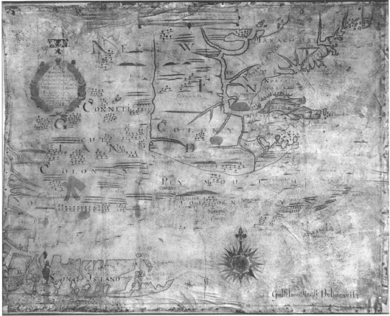
3. William Hack’s “Description of New England in America” (London, circa 1695–1700).
Pilgrim Society, Pilgrim Hall, Plymouth, Massachusetts
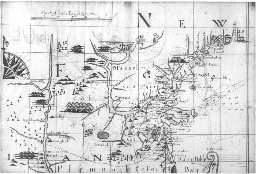
The British Library, London
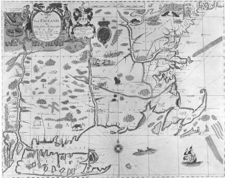
5. John Seller, “A Mapp of New England” (London, 1676).
Yale University Library, New Haven, Connecticut
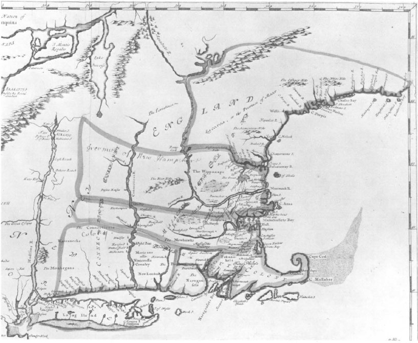
John Carter Brown Library, Providence, Rhode Island
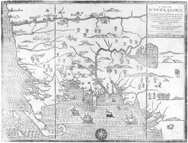
John Carter Brown Library, Providence, Rhode Island
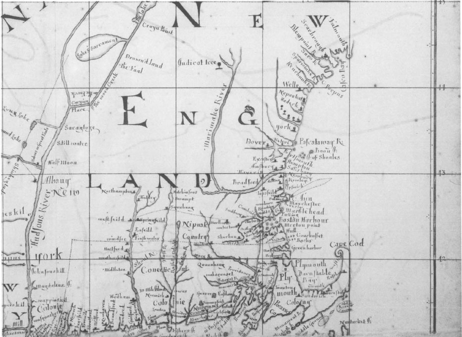
The British Library, London
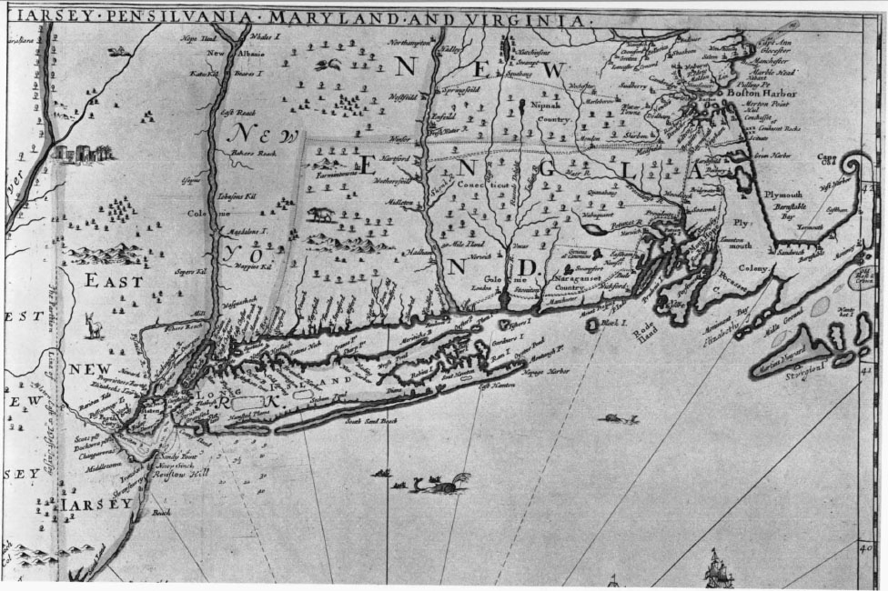
John Carter Brown Library, Providence, Rhode Island
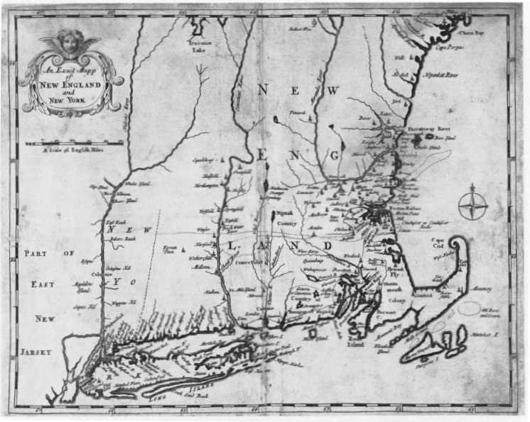
10. “An Exact Mapp of New England and New York” (London, 1702).
John Carter Brown Library, Providence, Rhode Island
The south and the west of the map are the province of Dutchmen. Up the Hudson, Bakers Reach sounds English, but more probably commemorates Jacobus Backer, schepen of New Amsterdam in the early 1660’s, who married Governor Stuyvesant’s half-sister Margaret and signed the treaty with the Indians of 15 May 1664 on Dutch behalf. “Ralph Johnsons kill” is still Rocliff Jansen kill [sic], after Roeloff Jansen, the name of a Swede from Marstrand who arrived in New Amsterdam in 1630, was in 1636 awarded a bouwerij in what is now Greenwich Village, but died within a year.3 Besides Block with his Island, a colleague appears on Hack’s map at “Wits Isle,” on the west side of the Hudson near Catskill, which Seller called “De Wits Isle.” This commemorates Captain Jan de With, who commanded the Amsterdam vessel de Vosken (Little Fox) in succession to Pieter Fransz, in 1613. Under de With the Vosken, like Block’s Tijger, was one of five ships sailing independently that were sent to explore New Netherland in 1614.4 As de With in 1613 turned back with Fransz’s men before they reached the Hudson, this name must commemorate his little-known 1614 voyage instead.
In New England proper, a very few names commemorate early English proprietors. Saybrook, founded in 1634, combines the titles of two colonial promoters and patrons of the Puritans—Robert Greville, Lord Brooke (1608–1643), cousin of Sir Fulque Greville, and a casualty of the Civil War, and William Fiennes, Viscount Say and Sele (1582–1662), who proposed to the Massachusetts colonists that there should be an hereditary aristocracy in New England, and who owned a plantation at Cocheco, Maine. In Rhode Island, Warwick was so named in 1642, in honor of Robert Rich, Earl of Warwick (1587–1658), parliamentary Lord High Admiral, and Commissioner for the colonies. It has been strongly argued that Point Judith in the same state (“P. Juda” here; generally accounted to be mysterious) owed its name to Judith, wife of Sir Thomas Barrington, Bt. (died 1644), who was a first cousin of Oliver Cromwell and “a close associate, both in Essex politics and in commercial and colonizing enterprise, of the Lord Lieutenant of the County, the Earl of Warwick.”5 All four—Barrington, Brooke, Say, and Warwick—were English territorial magnates and leaders of the Puritan opposition to King Charles I and his “Eleven Years’ Tyranny,” whose oppressions fired their colonizing ambitions.
The impress of explorers themselves is discreetly visible on New England’s eastern coast. Names are supposed to have been bestowed on some of the islands by Bartholomew Gosnold, who in 1602 pioneered the direct route from old to New England. “Elizabeth,” first given by Gosnold to the island known as Cuttyhunk but now applied to the whole group, was the name of his queen; Hack also gives the name to one of the islands off the Penobscot. Captain John Smith’s map names an island nearby “Barty’s Isle,” probably after Gosnold himself, while “Martha” for the Vineyard, on this analysis, is for Gosnold’s daughter and mother-in-law; the alternative form “Martin’s” here may be not just a mistake, but a memory of Captain Martin Pring, who also explored the area, having in 1603 been sent out by a rival group of merchants in Bristol.6 Within the hook of Cape Cod is West’s Harbour, which is common to Seller’s, to most of Hack’s maps, and to the Mather map: it appears to be a misnomer. Hack has evidently assumed that the allusion is geographical—but the “s” attached to “West” gives it away as a personal name. On Wood’s map of 1634 and on a state of Captain John Smith’s 1616 map New England, first issued, perhaps, about 1627, it appears as “Wests Bay,” attached not to a haven on the western side of Cape Cod such as Provincetown or Wellfleet harbors (Smith calls the former “Milford Haven”) but to a roadstead on the eastern side. The person commemorated is probably Thomas West, Lord De La Warr (1577–1618), in 1610 the savior, and the first regular Governor, of Virginia; he was a member of the Council of the Virginia Company when Smith undertook his voyage to “the northern part of Virginia.”7
Several other names that Hack uses are significant in terms of Smith’s famous map, even though his name “Smiths Iles” for the archipelago off the Piscataqua has reverted here to the older name “Isles of Shoals.” But Hack employs two out of the three Massachusetts names that alone survive from the ones carefully chosen for Smith by King Charles I, as Prince of Wales. The Charles River, which the Prince called after himself, is, of course, marked, but is not named. The two retained by Hack are Cape Ann, named after Charles’ mother Queen Anne of Denmark, and the town of Plymouth in the bay of that name, so called out of the Pilgrim Fathers’ conscious recollection of Smith.8 In Maine, Hack shares with Seller “C[ape] Porpis,” so named by Smith after the abundance of porpoises he witnessed nearby: the settlement changed its name in 1718 to Arundel and thence, in 1821, to the present Kennebunkport, and the “C. Porpis River” is, of course, the Kennebunk. To the north of this, both Hack and Seller designate as Winter Harbour the bay now known as Biddeford Pool: the earlier name commemorates the stay here, in the winter of 1616–1617, of Captain Richard Vines, Steward of Sir Ferdinando Gorges. “Champernoon Isle,” off the Piscataqua to the south, commemorates another of Gorges’ henchmen, Captain Francis Champernoun, the proprietor’s nephew. In the Piscataqua, the modern name Lamprey River, paralleling “Oyster River” nearby, is now believed to derive from the name of an early settler, often given as John Lamprey. However, Hack here and in a London map writes “Lambeth R.”, Seller has “Lambet R.” and Blathwayt’s map has “Lample R”, suggesting that “Lamprey” could have been an early corruption, or false etymology replacing the original name of Lambeth.9
Finally, Hack must have had an early identifiable source for one specialized group of names. Although he has no “Canonicus”, no “Bulls” and no “Swampfort” in mainland Rhode Island, some names in the vicinity of Providence inescapably recall King Philip’s War in its early stages. “King Philip’s country” would hardly have been singled out before the famous struggle broke out. North of Providence is “Spaw Sachem,” similarly given on Sellers’ and Morden and Berry’s related maps of 1676. This is, of course, a misreading for “Squaw sachem”: the squaw in question was not the better known Awashonks of the Sakonnets, nor Quaiapen, the “old queen” of the Narragansetts, but Weetamoo, sister-in-law to Philip, important because initially she remained pacific towards the English, but later became a reluctant ally of the Wampanoag chief. Nearby is “Mount Hope,” marking the home of Philip, alias Metacomet, near Bristol, where the Great Sachem was eventually killed.1 On all these maps is Swansea, also with significance in this context, as hostilities began with the Wampanoags’ June 1675 attack on it: incorporated only in 1668, it could otherwise easily have been omitted. Nothing in the Description can be defined as of indisputably later date, since Deerfield, the most recently incorporated town (1677) to be shown, had actually been founded in 1670.
The Description of New England: parallels among maps of the era
At the risk of puzzling the reader, some acquaintance with maps contemporary with the Description of New England has so far been assumed, in the interests of elucidating the latter’s geography and topography. To study the Plymouth map on its own for these purposes brings more complexity and confusion than placing it in its context among its fellow maps of New England. So far, as we have earlier shown that, as a document, this map could have been copied by William Hack only between December 1694 and November 1701; but we have also indicated that the territorial demarcations by which it divides New England can represent reality only from the 1640’s and that the main body of nomenclature is Dutch in the west and southwest, English in the center, north and east, and Indian sporadically through both areas. Features are recorded comprehensively, insofar as they originate before about 1660; later names are extremely sparse, with the exception of a small local outcrop reflecting the outbreak of King Philip’s War in 1675. To identify the sources from which William Hack has drawn the Description of New England any better than this, we must identify and consider the other maps of New England that share them. By doing so we can deduce priority and derivation among them just as, by such comparison, we have already restored to Hack’s map lettering that time had rendered illegible at first glance.
Of New England maps that Hack designed to stand on their own, only the one at Plymouth, curiously, has survived to the present day. Though now the subject of great interest, for a long time it was as good as lost. On the other hand, four other maps that Hack drew of New England have been known but have remained unexamined till very recently. All are in Hack’s manuscript atlas A description of Coasts Islands &ca. in the North Sea of America, and not one corresponds exactly to the Plymouth map in content or coverage. They also differ among themselves, but are not merely parts of a larger map: they differ in scale, too, and are contrasting rather than complementary delineations. None makes its relationship to the Description explicit, though naturally many of the features in it also occur in them.
Of the London atlas’ four New England maps, no. 3 is largest in scale and, so far as it goes, most resembles the Description. It alone indicates the swamp north of Brookfield (though without naming it), it alone has an enormous Lake Winnepesaukee bisected by the edge, it alone shows an Aquodock River and “Indicot trees,” and it alone caricatures the coast of Maine as a short stretch from Piscataqua northeast to the Kennebec. In all these respects, as in its places and the names for them, it resembles the Description. But it goes no farther westwards than the Connecticut, and no farther south than Middletown on that river, Manomet on the coast near Plymouth, and Barnstable on the Cape Cod peninsula.
Map 4, also a fairly large-scale treatment, likewise extends only to the Connecticut, but includes the whole coastline of southeastern New England. Up the Connecticut it goes only as far north as Enfield, but on Massachusetts Bay it ventures to Salem, Beverly and Gloucester, thus duplicating map 3 in the central area of Massachusetts. Map 4, however, reflects some later topography, as it marks Norwich, draws in the river system to its north, and names “Wochester” (first settled in 1674 as Quinsigamond, burnt next year in the War, rebuilt and incorporated in 1684).2
Map 5 is a remarkably bountiful view by Hack of New England, in which the minute intricacy of the legends makes up for the smallness of scale. The region, however, is only a detail on a vast map that also shows half Lake Erie to the west, Montreal and “Cubeck” (Quebec) on the St. Lawrence, and connects the Hudson to the Sorel and the Mohawk to the Great Lakes. This map has a long, northward-trending, Maine coast, includes the important towns (Kittery, York, Falmouth and Scarborough) there which the Description omits, marks in the river system north of Norwich, and adds others details not in maps 3 or 4 or in the Description. Map 6 is very comparable to map 4, but its western boundary is the Hudson, and New York, instead of the Connecticut. Its depiction of southern New England is obviously similar to that in the Description, but with later additions, as it has new features the Description omits. It has all the southern coast that is trimmed from map 3, but northwards stretches only to Bakers Reach on the Hudson, Enfield on the Connecticut, and Boston on the coast.
Thus, of the London maps, nos. 4, 5, and 6, especially the latter two, look distinctly later in content, and possibly in drawing, than map 3 or the Description at Plymouth. Essentially, maps 5 and 6 differ only in scale. Remarkably, almost everything they have in common is also on the map in Cotton Mather’s Magnalia Christi Americana, published in London in 1702.3 The Mather map has names of late seventeenth-century origin that had not yet occurred anywhere else, though it postdates the Description of New England by only a few years, at most. And though it is commonly called Cotton Mather’s map, it is quite unlikely that it really is to the design of the learned divine, so directly does it resemble maps 5 and 6 drawn by William Hack in London, where it was published.4
Cotton Mather was a cartographer of sorts, it is true, though only one unmistakable record of the fact has been found. In February 1677, when Cotton was fourteen years old and in his sophomore year at Harvard, his uncle Nathaniel, then in Dublin, acknowledged the map Cotton had just sent him in a letter to the latter’s father Increase Mather:
I much rejoyce in God’s great mercy begun in your son Cotton. I heartily thank him for his map of New England. It helps mee much in understanding your & other narratives. One defect or two I observe in it, there is wanting a scale of miles & a compass, & if I have not forgotten (which it is like I may) the Blew hills are misplaced. . . .5
In missing the scale and the compass, both prominent features of the Description, Nathaniel seems to be comparing his nephew’s drawing very much with a Thames School type of map. Again, he was sent it in 1676, just the year in which new maps of New England came out, proffering information on the earlier stages of King Philip’s War: the narratives Increase Mather and others were sending over probably were stories of the War. Within a year, an officially approved Massachusetts draft of New England was adapted as a war map and engraved on wood, in Boston: the first map published in America was one illustrating an account of King Philip’s War. Its events were probably what attracted the young Mather to mapmaking, too. But we have no other information about this early Mather map, nor has any trace of it been found.
The 1702 map differs essentially from the one we know Mather himself drew, as we can judge from the fact that it did not exhibit the Blue Hills drawn on the earlier map. According to Mather’s uncle, they were “misplaced, for hee placeth them south from Dorchester, whereas according to my defaced idea of the Countrey, they were rather northward from it.” The Blue Hills were, in any case, rather uncommon features on seventeenth-century maps, absent from Foster’s 1677 woodcut, from the 1678 Blathwayt map, from Morden and Berry’s 1676 map, from Richard Daniel’s 1679 map, from Hack’s maps 5 and 6 in the London atlas and from the 1702 Mather map. Only the Description of New England at Plymouth marks and names them near where Nathaniel Mather thought they ought to be, though they are shown unnamed on Hack’s map 3 and, seemingly, on Seller’s 1676 map. Elsewhere, the Blue Hills occur only on the Woodward and Saffery route map of 1642 which, so far as we can judge from the nineteenth-century lithographic copy, which is all that we have of it, places them to the south of Dorchester.6 This hints strongly that young Cotton Mather based his map, in whole or in part, on that of Woodward and Saffery.
A whole quarter of a century elapsed between A Map of New England illustrating Hubbard’s Narrative of 1677 and An Exact Mapp of New England and New York complementing Mather’s Magnalia of 1702. There is, however, little essential difference between them, an extension of area and an increase in place-names apart. James Truslow Adams observed that Mather himself belonged to the sixteenth century; certainly his style and concept of history did.7 The map in his history is very much a seventeenth-century product belonging to a type of map of New England prevalent for at least a generation past and exemplified in the work of William Hack in at least two major forms. As nothing about Cotton Mather’s cartography is known apart from Nathaniel’s 1677 criticism of it, we cannot trace the development of the 1702 map by studying Mather’s own work. Instead, its form and content plainly derive from maps made by others in the intervening period. So far as southeastern New England is concerned, the map in Mather is virtually identical with the area as shown in A New Map of New England issued in London by John Thornton, Robert Morden and Philip Lea from about 1685 onwards.8 A problem arises here insofar as this series of maps terminates at Cape Ann (incidentally, like Hack’s somewhat similar map 4) whereas the map in Mather stretches far north to Casco Bay. So a much larger, 4-sheet, map of New England by John Thornton has been found—undated, but dedicated to King James II—in a unique copy in the Bibliothèque Nationale, Paris: southern New England, up to Cape Ann, is apparently only one of its plates, and an upper one continues the coast appropriately to Casco Bay.9 In this, Thornton’s maps resemble the Magnalia map in having a far more realistic conception of the coast from the Merrimac to the Saco River than Hack’s Description does: this delineation has the coast running for a hundred miles first in a northerly, then in a north-northeasterly direction, only then curving east to the bays of northern Maine.
The Thornton topography of New England looks close to that of the Magnalia map because it, too, is engraved, but it is no closer to it in content than some other maps are, particularly William Hack’s. His manuscript map 5, in London, offers the same long northward-trending coastline from Cape Ann to the Kennebec that is missing from the Thornton, Morden and Lea maps as it is from Hack’s own maps 4 and 6. The engraver of the 1702 Magnalia map is anonymous; decorative features are no help in identifying him, as what there is also occurs to some degree in Hack’s work and is, in any case, commonplace. But the engraving recalls the rather ordinary work done for Thornton as the initial publisher of The English Pilot much more than the elegant and vigorous style of Hermann Moll, who had been engraving all the maps that Hack is known to have printed.1 However, authorship of the Magnalia map cannot lightly be taken from Mather and given to Thornton without careful consideration of the claims of Hack in the matter: it is quite conceivable that Thornton was publishing maps designed by Hack in drafts of which some survive in his atlas of . . . the North Sea of America.
Thus a highly recognizable type exists in the early Anglo-American mapping of New England. Strongly characterized features pervade all examples of it, from Seller’s and Morden and Berry’s maps of 1676 to the one of 1702 in Magnalia and including the woodcut, the Blathwayt map, Hack’s Description and other manuscript maps, and those published by Thornton, Morden and Lea. Common to all these are deep, almost exaggerated, coastal indentations, a bulky and foreshortened Long Island, unequaled notice of the islands and shoals off the southeastern coast, the south shore of the Cape Cod peninsula inclined by almost 45° so as to run from southwest to northeast, a curling extremity to that cape making it recall a snail shell, and overemphasis of the Merrimac River. This was the delineation of New England that prevailed in maps produced between about 1675 and 1720. All the maps have a strong family resemblance: more than anything else, it is difference in the purposes and methods of their manufacture that accounts for variations among the maps.
Differences of content are largely modest improvements of proportion, mainly in the north, and progressive addition of topographical details. Remaining within this group, two, if not three, models are observable in Hack’s work. Except for their draftsmanship and their calligraphy remaining so alike, Hack’s earlier and later maps of New England resemble one another much less than they do maps of either date by other cartographers. For instance, we may ignore, though not deny, the possibility that Cotton Mather drew his own map for Magnalia in 1702, since we have no evidence that he did and we know that it differs from his 1676 map in the one essential particular we know about the latter. But the Magnalia map is the closest parallel to Hack’s manuscript maps 5 and 6, whereas his map 3 echoes the cartography both of his Description of New England at Plymouth and of John Seller’s printed map.
While this pervasive map type was being composed, two major historical episodes impinged on public consciousness in New England, and decisively altered the conceptions that mapmakers had of the region. First was the mine relentlessly ticking away under the theocratic oligarchy maintained by the Puritans in the colony of Massachusetts Bay under the charter King Charles I had given it in 1629.2 We must understand the peculiar, vague definition this charter gave to Massachusetts’ boundaries to appreciate how hazy was geographers’ comprehension of what is now the eastern United States, and how New England cartography was doomed for years to stagger under the weight of misconception, despite the labors of such as Hubbard, Seller, Hack, and Thornton. For fifty years the constitution of Massachusetts, the 1629 Charter defined the Bay Colony’s areas thus:
All that parte of Newe England in America . . . betweene a greate River . . . called Monomack alias Merriemack and a certen other River there called Charles River . . . And also . . . those landes . . . lyeing within the space of three English Myles on the South parte of the saide Charles River, or of any, or everie parte thereof. . . . And also all those landes . . . which lye and be within the space of three English Myles to the Northward of the saide River called Monomack alias Merrymack or to the Northward of any and every parte thereof. And all landes . . . lyeing within the lymyttes aforsaide North and South in latitude and bredth, and in length and longitude of and within all the bredth aforesaide throughout the mayne landes there from the Atlantick and westerne Sea and Ocean on the East Parte, to the South Sea on the west parte.3
Underlying this was, of course, the assumption that the Charles and the Merrimac both ran from west to east, more or less parallel to one another, so that lines based on them would be appropriate for a new colony bounded to the south by the Colony of New Plymouth, already planted in 1620, and to the north by settlements made under patents already granted to Captain John Mason and Sir Ferdinando Gorges. The neighboring colonies were all approved in a rapid sequence of patents issued in 1621, accommodated within the land stretching from Atlantic to Pacific between 40 and 48 degrees of North latitude that James I had granted to Gorges by charter. After John Pierce received the patent for New Plymouth, the Council for New England awarded Mason the land between the Naumkeag and the Merrimac rivers (i.e., the coast from Salem to Newburyport), and conferred on him and Gorges jointly the area from the coast between the Merrimac and the Kennebec up to sixty miles inland, plus the islands within fifteen miles, to be the Province of Maine.4
Both of the latter two 1621 patents, of course, stood in the way of anything that the terms of Massachusetts Bay’s 1629 Charter could possibly mean. The Bay colonists may be forgiven for thinking their claims, set up later and by the superior instrument of a royal charter, should be preferred; though, unlike the Virginia colonists, they were farsighted enough to remove their Company’s charter physically from England and thus, as they thought, obviate royal afterthoughts about royal generosity. In this context, the Puritans insisted, less reasonably, that their map-makers fit New England’s geography to the 1629 charter terms, even though experience since 1629 showed that that geography was other than had been then supposed. Already about 1637 Governor John Winthrop admitted that the Merrimac “runnes 100 miles up into the Countrye & falles out of a ponde 10: miles broad.”5 Would that these figures had been known to Hack when he drew the Description of New England, as they are within measurable distance of the truth. Instead, he fitted his lake to Massachusetts’ official conception of it, showing how events since Winthrop’s time had inflated the image that the Bay colonists had of both the river and the pond.
The elect of Massachusetts Bay viewed the giant bend from Andover round to Penacook and the generally north-south direction that the Merrimac proved to have as giving them a dramatic corresponding increase in their land area. Perhaps it was even Divine favor for their bounds to be so enlarged: the charter’s wording “three English Myles to the Northward . . . of any and every parte” of the Merrimac seemed to them to entitle them to everything up to the parallel of latitude three miles north of the river’s source, now found to lie, by God’s grace, in Lake Winnepesaukee, at least a hundred miles farther north than had initially been supposed. The Charles, on the other hand, offered no such opportunities for aggrandizement, as it flowed generally from southwest to northeast. But under Governor John Endecott’s assertive leadership Massachusetts staked its northern claims out on the ground. Inland, markers were planted at the exit of the Merrimac from Lake Winnepesaukee in 1652, and on the coast the same latitude was found and marked at Casco Bay in 1653.6 Both points are on Hack’s Description, the former shown by the so-called “Indicot trees” which are not, as might be guessed, an attempt to transculturate the tropical indigo plant to northern New Hampshire, but Hack’s version of “Endecott’s trees,” a term found less corruptly on eighteenth-century maps.
The Description of New England, though, is not so much the sibling as the cousin of maps made in the 1670’s expressly to advocate Massachusetts’ inflated claims for its northern boundary. Most evident is its relationship to the drawing of New England in the Blathwayt Atlas, which Miss Black has suggested “is the first official map of Massachusetts and the first locally made map of New England—copied twice over . . . but copied by professionals under official supervision.” Interesting as an example of the secretarial copy that was the alternative to a decorated Thames School chart, it is significantly endorsed by Blathwayt “Merrimack River This Map was copied out of an Originall lent by Mr. Stoughton & Bulkeley Agents of Boston. . . .” In it, four colossally prominent features leap to the eye: overpoweringly obvious “Paralel” lines running from east to west across the map, intransigently expressive of Massachusetts’ claims under the 1629 Charter, a latitude scale unusually superimposed across the map to measure the parallels by, a monstrously distended Lake Winnepesaukee, and a conspicuous and complex course for the Merrimac, implying it was all one watercourse while coiling it up like a concertina to reduce the impression of its true length.7
These overbearing parallels connect the Blathwayt map with one superficially very different—the small woodcut made in Boston in 1677 by John Foster, the first printer in that city. It illustrates A Narrative of the Troubles with the Indians in New-England, from the first planting thereof in the year 1607, to this present year 1677, by the Revd. William Hubbard, minister of Ipswich; it was he who drew up the lengthy table of the scenes of hostilities printed in the text, to which the numbers on the map are keyed. Hubbard’s prime responsibility for the map is signified not only by the closeness of its features to his text (without which the map is hardly intelligible), but by the gratulatory verses addressed to Hubbard, probably by Benjamin Tompson, that are overlooked when the map is solely ascribed to Foster, as it usually is:
Moxon who drew two Globes, or whosoere,
Must make a third, or else the old ones tear,
To find a Room for thy new Map, by which
Thy Friends and Country all thou dost enrich . . .
Hubbard’s is a war map intended to show the campaign and atrocities of King Philip’s War, then just concluded. Neither the two parallels nor the exaggeration of Merrimac and Winnepesaukee in it serve any useful purpose, so their presence indicates they were prominent on the original from which Foster carved the woodblock. The map is significantly called “the first that ever was here cut, and done by the best Pattern that could be had, which being in some places defective, it made the other less exact: yet doth it sufficiently shew the Scituation of the Country, and conveniently well the distance of Places,” as Hubbard and Foster explain deprecatingly in terms that could almost as well be applied to Hack’s Description, in defense of its inexactitudes.8
In comparison with the Blathwayt map, and with Hubbard’s, Hack’s has no emphatic parallels of latitude. Indeed, no lines of any sort mark Massachusetts’ Charter boundaries of 1629 although the northern border of Hack’s map corresponded roughly to the boundary under those claims. Indeed, because he so grossly distorts the latitudes of the Maine coast in the Description, Hack even appears to go one better, taking Massachusetts’ claims to the Kennebec, and not merely to Casco Bay. His latitude scale is not superimposed on the map, as it is on the Blathwayt map. But both Hack’s map 3, in London, and his Description, at Plymouth, make their Merrimac rival the Mississippi in size, and make it flow from the southern hemisphere of a giant Lake Winnepesaukee, as John Seller did in his 1676 map. To judge by the scale Hack superimposes on the lake, he thinks it measures a good eighty miles across, at the neat line, where the realistic Governor Winthrop had thought this “pond” ten miles wide.
King Philip’s War was the other major episode to enrich maps of New England in the 1670’s. Hostilities began when King Philip—Metacomet, grandson of the sachem Massasoit who had welcomed the Pilgrims to Plymouth in 1620—led the Wampanoag warriors to raid the exposed settlements the colonists had recently made at Swansea and Mattapoiset, and to burn Miles’ garrison house nearby. In southern New England, at any rate, the war ended almost where it had begun, with Colonel Benjamin Church’s dramatic slaying of Philip near his Mount Hope headquarters near Bristol, Rhode Island, and the capture of his old comrade Annawon there, in August-September 1676; major conflicts, though, continued in Maine till at least 1678.9 Journalists and cartographers were anxious to record a struggle so bitter, yet so picturesque, as King Philip’s War: as John Melish, publisher of A Military and Topographical Atlas of the United States, remarked, “the events of war, though often distressing in their nature, produce at least one good effect: they excite curiosity, and become subservient in a high degree to the dissemination of useful information.”1 Ample proof of this can be found more recently than the War of 1812, but American geography has been benefiting from war since at least 1675.
War-related information came to cartographers’ attention in at least two main stages, as the successive additions to their maps attest. Indications of the growing conflagration in New England were not wanting in London in the fall of 1675; on 21 December a manuscript newsletter compiled there conveyed the general view: “By a vessell arrived from New England we have advice, that the Indians grow dayly more and more considerable, that they have burnt four or five towns, and that they have cutt of all Provisions from those of Plymouth and Boston to the degree that unless supplyed from abroad they cannot be able to subsist. All trade and commerce . . . by this means are at a stand there, and the most fearfull apprehend they shall be quite destroyed by the Indians.”2 Shortly afterwards, the publisher Dorman Newman brought out, as The Present State of New England with Respect to the Indian War, the text of a letter in which a Boston merchant, said to have been Nathaniel Saltonstall, related some of the events in King Philip’s War from June to November 1675. Newman advertised the letter as in print on 10 February 1675/6.3 This was exactly when Robert Morden and William Berry advertised for sale A Map of New England, New York . . . (etc.), engraved for them by Gregory King: there are two copies of this map in the John Carter Brown Library’s Blathwayt Atlas.4 It covers a wider area than A Mapp of New England which the King’s hydrographer John Seller, in his turn, advertised for sale in April 1676; even in the area mapped both by Seller and by Morden and Berry, the details are not the same. Yet both maps show, identically, places that had occurred on no printed map until 1676. Not only is the southern part of New Plymouth labelled “King Philip’s Country” in both, with Swansea inserted close by, but the new maps feature Mount Hope on Bristol Neck, as Philip’s headquarters, and “Spaw sachem” north of Providence, to represent those of his sister-in-law Weetamoo.
These four war-related names also appear on the Description of New England and on Hack’s map 3. We have seen that these two maps are parallel, or related to Seller’s map (rather than to that of Morden and Berry) in almost every way: what most betrays their common lineage is the presence of identical mistakes in all three. But how, exactly, is Hack’s work as seen in the Description related to Seller’s? The enormous number of place-names in common do vary, in minor particulars, and in the Description Hack enters a few more than either Seller or his own map 3 show; most obviously, Hack’s Description and Seller’s Mapp are completely different in their decorative schemes, in both cases a leading element of the map. Thus we cannot say Hack simply copied Seller’s map of 1676 when he drew the Description between 1694 and 1701; rather, he worked from some model that all three maps had in common. On it, the two mapmakers superimposed the inessentials that they respectively considered suitable, and in reproducing it they made their own characteristic errors. This model also influenced the map Morden and Berry had published even earlier, as the similarity of some of its place-names to Seller’s and Hack’s shows.
Seller’s 1676 map was accompanied on publication by A Description of New-England, Published by John Seller, a broadside leaflet in four pages, containing geographical information extracted from An Account of two Voyages to New-England (they had been made in 1638 and in 1663–1671) by John Josselyn, an adherent of the Gorges interest in Maine, who first published his book in London in 1674. The map is known in two states (Yale has both, the John Carter Brown only the later, complete one), the first of which lacks the grid of latitude and longitude lines with which the Thames School would have begun, not ended.5 This first state also lacks the animals and scenes which are prominent on the second state but differ totally from Hack’s scheme in his Description. The fine large vignette “The manner of Indian Fortifications Town’s Houses and Dwelling places” vividly shows two forms—one round, the other rectangular—of palisade containing wooden buildings, reminiscent, it is true, of the fortified Narragansett village with which the colonial army contended in the Great Swamp fight of December 1675. Yet in detail these are more the constructions of the Iroquois than those of the Algonquins. When we look back on the cartography of the northeast of America, we see why. Adapted to the shape and space available, this vignette regularly appeared on all the Dutch maps of New Netherland engraved from 1635 onwards, starting with Blaeu’s and proceeding to Janssonius’, Visscher’s and Allardt’s.
What is uniquely novel in Seller’s map is a naive but vigorous little vignette placed on the Connecticut’s east bank near Hadley, Massachusetts. A little band of colonists in it is using flintlocks and pikes to drive off arrow-shooting Indians; in situ, the scene may represent one of the several bloody skirmishes of August-September 1675 around Hadley.6 This is the only war information from later than July 1675 to be discerned on any of the 1676 vintage of maps, none of which, apparently, felt any need to record the great garrison houses of the Narragansett area which were to be battlegrounds in the fall and winter of 1675–1676. Richard Smith’s near Roger Williams’ still extant “castle” at Wickford, Jireh Bull’s at Pettaquamscutt to its south, John Woodcock’s near Attleborough to the north all appear, however, in the Thornton, Morden and Lea maps, in Hack’s own later work, and in the Mather map of 1702.7 These also note such sites in the area as Swampfort and Canonicus, needed to show the winter campaign, and Hutchinson’s Swamp indicating the late summer fighting in the Nipmuck country. Thus the model of map which William Hack copied for Sir Walter Yonge in 1695 or later can be dated to January 1676, as though the clock had stopped twenty years earlier.
The Description of New England: origins
We have now taken William Hack’s Description apart. Each piece we have compared, cursorily at least, with maps issued by such of Hack’s contemporaries as John Seller, Robert Morden, Richard Daniel, and John Thornton in England. Outside the London map trade, comparisons have been suggested with the maps made at this time for the two New England divines, William Hubbard and Cotton Mather, and with the map copied at the behest of William Blathwayt, eventual confrere in government of Hack’s patron. After 1675 the maps that were made of New England clearly embodied data that could not have come from explorers, sea captains and traders alone. The time was not yet ripe for the British government to send surveyors—naval, military or civilian—to the American colonies, as it did nearly a century later. Patchy though it was, the information on the interior of New England that was reaching cartographers by 1675 could have come only from settlers there, no matter for what reasons they supplied it.
The major bays in the middle Atlantic region of North America were all explored in the seventeenth century’s first decade by Henry Hudson, who in 1609 ascended his river to a point above Albany. By 1614, Dutch explorers were familiar with the Sound and the major inlets of Long Island, with the Connecticut River (which Block explored up to the head of navigation), the Delaware and the Susquehanna. By 1634 they knew most of what there was to know about the Mohawk and the route to the Great Lakes.
English progress into their hinterland was much slower and more piecemeal. Clearly, till after 1630 they can have known nothing of the upper courses of those rivers that flowed into Massachusetts Bay: otherwise the course of New England cartography, and even of New England history, would have been different. At Plymouth, the Pilgrims had several years start over the Puritans of Massachusetts. But they remained few and far between: as late as 1630 there were only about three hundred of them, relatively few literate, and their colony was only just out of hock to its London backers. No original cartography has been reported from the earliest years at Plymouth. But admirable presettlement renderings of New England’s east coast were available in London, and even in New Plymouth, in the shape of Samuel Champlain’s and John Smith’s published maps.
On the other hand, the southern coast was rescued from the sixteenth-century’s Norumbega fantasy only by the industry of the Dutch charting New Netherland. Henry Hudson, Cornelis Hendricksz and Adriaen Block defined the shape of New York Bay and the relationship of Staten and Manhattan Islands to the mainland; they were the first to insist on the separateness of Long Island and the first to chart it correctly. The early colonizers owed their knowledge of the shores of Connecticut and Rhode Island to Block. Narragansett Bay he investigated, but charted much more vaguely, creating thus early an unfortunate distinction in cartographic quality. This was to be accentuated by the early poverty and isolation of Rhode Island, so that up to the later eighteenth century Narragansett Bay, the finest harbor on North America’s east coast, was much the worst mapped. Most early colonial mapmaking was executed under the auspices of Massachusetts, relatively large and fast-growing: hence the disproportionate effect on New England cartography of the boundary obsession in the form in which the Bay colony uniquely entertained it. Acrimonious and unproductive though Massachusetts’ behavior may now seem, it did cause explorations to be mounted, and maps drawn, that otherwise would not have been undertaken: an early example of the “cartography of conflict” which has always spurred on the mapping of America.8
The first New England map by a settler was drawn in Massachusetts. Unlike his successors, though, he ground no political axe, and straight-forwardly showed the first areas of southeastern New England to be settled. The young Englishman William Wood turned his inquiring mind and fluent pen to the description of the new colony as soon as he arrived in it in 1629; on his return to England in 1633, his draft was cut in wood and published in his New Englands Prospect (London, 1634).9 Errors can readily be spotted in the relatively crude drawing, but it was the first map published by anyone who lived in New England, and it drew the estuaries of the Mystic, Charles and Neponset Rivers more lucidly than any map till then made. Nowadays, this would be considered a map of Boston’s commuter belt, but it has special value as the first to map numerous historic towns (later indicated by Hack in his Description) and as the only depiction of how close the Indian presence initially was to Boston, shown ringed round by the residences of the various sagamores of the Massachusetts. Though more a diagram than a finished map, Wood’s drawing was immediately influential: the tenth and last known state of Smith’s New England map, ascribed to 1635, is distinguished by an advertisement for Wood’s book and for having some real geography around Boston derived from it, to contrast with the fanciful town names Charles I had suggested to Smith for the original map.
By now, however, no mere revision of Smith’s map would satisfy old England’s curiosity about New. The papers of the Council for New England for 1632 include a note reading “Mr. Saltingstall desired to make a map of Salem and Massachusetts Bay for the Council,” in apparent reference to Samuel, son of Sir Richard Saltonstall.1 Whether this elicited a suitable response is unknown, but the second cartographic document of Massachusetts Bay in any case followed soon after. This is a bold, semi-pictorial manuscript now known as the Waters-Winthrop map, depicting the partially settled eastern part of Massachusetts from the lower Merrimac to well south of Quincy Bay, and from Cape Ann and Conyhasset on the coast to the Sudbury (“musketaquit”) river.2 Its topographic strengths include vividly specific hills and woodlands, careful delineations of the courses of rivers and the shapes of ponds, and figures for the depths of the latter. Perhaps drawn in 1633, it shows the area of settlement still reaching only to Medford, Watertown and Dorchester, all so named. Ipswich (so named from 1634) and Weymouth (from 1635) are entered as Agawam and Wessaguscus, respectively. On this draft have been identified valuable topographical notes by Governor John Winthrop, apparently written about 1637, when he remarked on the length and source of the Merrimac. Very soon after this may have been when the map was sent to England, for Winthrop has been asked in September 1636 for “the plott or mapp of New Englande” by his friend Robert Ryece who, in a further letter of January 1637, repeated: “I am styll a bold petitioner to you to helpe us to a mappe of your contry as it is now inhabited, & is ioyned with new plantation of Conetticote.”3
The Waters-Winthrop map could have met the first part of Ryece’s request, but the second part of it tarried till 1642/3 to be satisfied, in the celebrated map of the interior of southern New England made by Nathaniel Woodward and Solomon Saffery. In 1749, in his derisive way, Dr. William Douglass called them two obscure sailors, and later historians have joined him in fancying that Woodward and Saffery took their essential measurements by sailing from Boston around Cape Cod to the Connecticut.4 But the copy of their map, and documentation surviving to put it in context, make it clear that they proceeded to that river overland. It was they who first recorded the main way from Massachusetts Bay to the recently founded settlements on the Connecticut River, both those centered on Hartford, which became the colony of that name, and those around Springfield, which were initially deemed part of it, but were destined to remain in Massachusetts. The mission the two had, precisely, was to establish the southern boundary of the Bay colony, demarcating it from the Colony of New Plymouth and from Connecticut, in accordance with the 1629 Charter. It was not only the greater regularity of direction of the Charles’ course but also the surveying of Woodward and Saffery that insured less objection was taken to Massachusetts’ southern boundary than to its northern one based on the Merrimac.
As described thirty years later by a companion, Woodward and Saffery took the trail from Boston southwards towards Seekonk, but turned off to the pond out of which the Charles flowed; thence they measured three miles south, by chain, and awaited a clear sky to observe that the latitude was 41° 55′ North. They measured it again at Roger Williams’ recently founded Providence, at the Moswansicut River in Rhode Island and near Pomfret and on the Willimantic River in Connecticut, before coming to the river crossing at Windsor where “the Artists took again observation having a clear horizon.” They then had Connecticut’s Governor accept their measurement, before going on westwards from Hartford to the trading house of Oronoco, where they arrived on 14 April 1642; then, finding Springfield was in 42° 6′ of North latitude, they took the Bay path back to Boston, via the Chaubunagungamaug and Cochituate ponds. In 1645 John Winthrop, Jr., going to take possession of a grant at New London, traveled this approximate route, in reverse: the numerous topographical remarks in his Latin diary fill out what is known of Woodward and Saffery’s travels. The original of their map has disappeared, but Winthrop’s diary helps corroborate the copies of it that survive in the Massachusetts Archives.5
This is the total of early settler mapping of New England that has survived. But more than this was done. Massachusetts’ increasingly vociferous claim to boundaries three miles beyond any part of the Charles and of the Merrimac logically necessitated so lengthy a journey if the latter were to be measured that the northern survey perforce lagged far behind the southern. In 1652 Governor John Endecott set on foot an expedition including Captain Edward Johnson, John Sherman and Jonathan Ince. Sherman and Ince reported they had found the source of the Merrimac to be at Aquedahian “where it issues out of Lake Winnepesaukee, upon the first of August [1652]”—the locality marked as “Indicot [i.e., “Endecott’s”] trees” in the Description.6 Surveyors promptly paralleled this reading on the coast of Maine (1653), after which Massachusetts forced Kittery, Wells, Cape Porpis (Kennebunk), Saco and all of Maine up to Casco Bay to submit to them. As they had already seized control of Dover, New Hampshire, and had chartered the town of York to supplant the proprietor’s Gorgeana, the patent rights of Mason and Gorges were by this entirely overthrown. Neither a drawing nor a narrative of either of these expeditions has come down to us, not even a route map such as Woodward and Saffery had made a decade earlier, yet one cannot conceive of these expeditions not producing even a sketch map.
Sixteen hundred and sixty, when Charles II was invited back to London, was unfortunate for the Massachusetts Puritans, as it ended both republican England and its benign neglect of their activities. By 1664 they found they had on their hands Colonel Richard Nicolls, as leader of a royal Commission including Sir Robert Carr, George Cartwright and Samuel Maverick. Nicolls and his colleagues were to establish royal authority in New England as well as in New Amsterdam, which they were directed to take over; they were to settle the colonies’ boundary disputes, make their laws conformable to the laws of England and put the Navigation Acts into effect.7 On arriving at Newport in May 1664, they requested “that a map of your jurisdiction & limits might be made ready” which they wanted “made with all exactnes possible, & with all speed convenient delivered to us, for without it, we shall neither well understand your bounds, nor be understood in discussing of them,” and they added, significantly, “we shall not trouble you to send any to shew us your southerne bounds, they being uncontroverted, & at so great a distance from you.”8 The General Court of the colony thereupon turned to Captain Edward Johnson as a survivor of the 1652 expedition up the Merrimac, and on 3 May 1665 directed him and William Steevens “to draw up a map of this colony which they are to doe with the greatest care & best exactness they can, & [they are] impoured to call in & make use of what artists they shall judge needfull.”9
A year later, on 24 May 1665, the General Court sent the commissioners one copy of the map they had ordered from Johnson and Steevens, glossed by an eight-page paper entitled “Certaine reasons tending to manifest that the patent right of the northerly line of the Charter doeth belong to the Massachusetts colony in New England.” Affidavits on the ascent of the Merrimac in 1652 and on the expedition to Casco Bay in 1653, together with sworn testimony that the river’s source really was Lake Winnepesaukee, accompanied it.1 About the significance of what they sent, the General Court explained “We have herewith sent you a map of the lands we conceive to be granted to us by our charter. Our southerly limits are uncontroverted (so far as we know) & as yourselves are pleased to express some pretences & claims we know are made against our northerly line, in relation whereto we shall be ready whenever you please . . . to declare the grounds & reasons of our claime.”2
It is clear from the record of payment for the map, dated I June 1665, that a certain Mr. William Reed of Boston (not otherwise identified) actually drew it at the request of Johnson and Steevens. He must have made at least three copies, in all, because the General Court voted to pay him £ 10 “upon delivery of one draught more than he hath already given unto this Court.” There is little to show on what sources Reed could call to make a map of Massachusetts (and what is now southern Maine and New Hampshire) quickly. The 1642 map by Woodward and Saffery in the colony’s official papers must have been as available to Reed as it apparently was to young Cotton Mather ten years later. For Massachusetts Bay itself, there should have been a copy of Governor Winthrop’s map of 1634/7, and probably an example of William Wood’s published map and of a late version of Captain John Smith’s map of the eastern coast. But these could provide only a beginning for Reed’s compilation. Other sources must have been on hand in Boston in 1665 that represented topography elucidated by the whole first generation of settlement: local surveys, agreements with Indian sachems, contracts for settlement, harbor drafts, plats, and incorporations of towns. Almost all of this practical early topography has now been completely lost, but an example that has survived to show the valuable informal records that either the earliest settlers or the Indians, or both, could produce is the John Carter Brown Library’s enigmatic map of the mouth of the Patuxet River, sketched on the back of the deed by which the sachem Miantonomo conveyed the land for founding Warwick, Rhode Island, in 1642.3 A piece of topography we may be sure then existed was a sketch map, or expedition journal, or both, of the Merrimac exploration of 1652, that Colonel Johnson should have been able to give Reed, together with eye-witness testimony about the river.
At length, after Nicolls had gone off to be the first royal governor of New York, George Cartwright was, in July, charged to be the commissioner to bear findings, papers, and maps to London, for the King and government there to settle contentious points. However, by this time the war provoked by the English seizure of New Amsterdam was in full swing. Cartwright’s ship, escorting a slow transport laden with a vital cargo of New England masts, fell in with a Dutch privateer which eventually deposited the passengers in Spain: Cartwright had had to dump the commission’s papers and maps overboard to keep them out of enemy hands. Naturally, he did not get to England quickly.4 Meanwhile Nicolls wrote from New York to the Secretary of State reporting that the loss of papers “and the maps of the several Colonies” had thrown the commissioners “into no little confusion.” Nonetheless, he delayed until April 1666 before sending copies of the New England papers, and there is no explicit mention of maps being among them, even though at least two copies of the map William Reed had drawn the previous year remained in Boston.5
It is fortunate that meanwhile circumstances required Cartwright to tax his memory to describe the New England map lost at sea, so that we have some idea how it was drawn up and what it looked like (the Boston copies of it have long since disappeared):
They caused at length a Mapp of their Territories to be made, but it was made in a chamber by direction and guess. In it they claime Fort Albany, and beyond it all the lands to the South Sea [i.e., the Pacific Ocean] By their South line they intrench upon the Colonies of new Plymouth, Rode Iland, and Conecticot; and on the East [i.e., as regarded New Hampshire and Maine] they have usurped Captain Mason’s and Sir Ferdinando Gorges patents.6
Nowhere is it said that Reed’s map included New Plymouth, Rhode Island or Connecticut, only that it showed Massachusetts encroaching on them. The Crown was unlikely to countenance such encroachments, since the Pilgrims had been in Plymouth since 1620 under a patent valid from every point of view, while Connecticut and Rhode Island had each received the royal accolade in the form of charters conferred so recently as 1662 and 1663, respectively. However, obstruction continued from Massachusetts to the government’s designs to bring it to the same status and obedience as other colonies. For nearly ten years, owing to administrative problems and the preoccupation of the few able men by more pressing business, nothing radical was done about New England. The nearest the Council for Plantations came to taking up the subject actively was at times in 1671–1672, when it was prompted to seek New England maps from Colonel Nicolls, now back in London after his governorship of New York, and from the curator of the King’s own collections.7
Thus the chief compilation of New England cartography, and its redaction into a map approved at least by Massachusetts Bay, had already occurred, in 1665. This map put together hastily for the General Court by William Reed is the only one that has come to our notice that was comprehensive enough, and was accessible to influence maps of New England made in Europe; yet its influence cannot be detected till ten years or more after it was made in 1665. The public for maps, particularly of these colonies, was growing and well informed, with lively commercial interests at heart, and a strong concern paralleled these interests in several offices of the government. But until 1675 they all had to be satisfied with maps that were fundamentally Dutch ones, supplemented to varying degrees with maps by the explorers of the very earliest years of the century, Champlain and Smith. Suddenly, in 1676, examples of a new type of map of New England were marketed. A year earlier than the Hubbard-Foster woodcut of New England published there in 1677, these new maps are likewise remotely based on the same Boston-drawn original manuscript map—the “Pattern” of which the woodcut’s title legend significantly speaks. Contemporary use of this type of map to show what happened in King Philip’s War depended on the coincidence that it was newly available at the time, whereas the original compilation of the map and its transmission to London were provoked by Massachusetts’ desperate struggle to keep the Charter of 1629 in force, and retain the inflated boundaries it claimed under it.
It is the presence in the John Carter Brown Library’s Blathwayt atlas of a London-made copy of one of these maps proclaiming Massachusetts’ charter boundaries that lets us document a sure, but late example of the transmission of this map type to England. The original of the Blathwayt copy cannot have left Boston till the two agents chosen to represent the colony in London sailed in October 1676, so it cannot have been available in London till the very end of the year, whereas the maps by Morden and Berry and by Seller and, perhaps, the model for Hack’s eventual drawing of the Description of New England for Sir Walter Yonge were all made at the beginning of that year. When did a version of Reed’s New England map made to suit Massachusetts in 1665 first reach England? It must have been in 1675 at the latest, but there is nothing to show how much earlier in the preceding decade it might have been. In our present state of knowledge, we do not know whether the copy of Reed’s map that Cartwright had had to sink in 1665 was, in fact, immediately replaced, whether (as the records seem to hint) a copy was later brought to London and made available by Nicolls on his return there, or whether channels of merchant or private correspondence completely unknown to us transmitted it at some date in the decade. But it must have been at some time during these ten years that the most important single source for William Hack’s mapping of New England came into the hands of London mapmakers, and he cannot have needed to wait to see this map till the end of 1676, when a copy certainly did arrive in the baggage of the Massachusetts agents.
They were reluctantly and belatedly sent because when William Blathwayt’s masters, the Lords of Trade and Plantations, were erected into a permanent colonial administration in 1675, they had resolved to put an end to Massachusetts’ impossible charter, indefensible franchise, illiberal laws, and total refusal to cooperate with imperial policy. Blockading the port of Boston with frigates, and sending a royal Governor-General at the head of regular troops—the only thing wrong with such measures was that they were a century before their time—were both suggested to the government in 1676 as ways of dealing with the Massachusetts problem.8 But the government had the patience merely to require that the refractory colony send two agents with full powers to revise the 1629 Charter. Massachusetts was only too well aware that its broad claims on its neighbors were highly vulnerable to London’s attention, and to meet this threat, named two specially able men: Peter Bulkeley (1643–1688) of Concord, Speaker of the lower house of the assembly, and William Stoughton (1632–1701) of Dorchester, later Chief Justice and lieutenant governor of Massachusetts.9
Theirs were the names that Blathwayt endorsed on the map he obtained in 1678. The better to defend the Charter, the General Court had determined that its agents going to London should have a map to show the boundaries claimed for Massachusetts under it—the map eventually lent by Sir Robert Southwell to Blathwayt for copying. The General Court evidently turned back in 1676 to the map it had had William Reed draw for a like purpose in 1665: it will be remembered that at least two copies of it were then made, besides the one lost at sea. For the 1676 copying Edward Rawson, secretary of the Court, employed James Taylor.1 He was a surveyor who had worked near Springfield to establish the bounds of a patent on the southern border of the colony, “protracting the line formerly draune by Nathaniel Woodward & Solomon Saffery,” but none of his actual work has survived.2 For his version of the 1665 map that provided Blathwayt with an original to be copied for the Lords of Trade he was belatedly paid ten shillings, by Rawson’s order, in January 1677.3
Despite the tact and skill that Bulkeley and Stoughton showed, in the discussions that eventually began London could not but notice how evasive were their instructions from the rulers of Massachusetts to complain freely, and petition for further royal indulgence, but to plead lack of authority to discuss revision of the charter.4 In 1677 the Lords Justices upheld Colonel John Mason’s original patent, though they disallowed his heirs’ claim to the whole area north of the Merrimac, since Massachusetts had effectively occupied the three-mile-wide strip there at issue (shown as part of Essex county in the Description) for so long. In 1679, therefore, the day came when Massachusetts reluctantly gave up what the Description shows as old Norfolk county, to become the nucleus of the royal province of New Hampshire. The claims to Maine of the heirs of Mason and Gorges were, however, evaded, so that Massachusetts was able to retain the province as its Eastern District till 1820.5 It was the Lords of Trade who effected these changes, for which purpose they deputed one of their number, Sir Robert Southwell, to report on the controversy and its background: it was in the course of this duty that he obtained the Massachusetts map from Bulkeley and Stoughton which Blathwayt then had copied for posterity.6 Certain pervasive differences between this copy and the naming of the same elements in the work of Seller, Hack and their fellow mapmakers suggest that the 1676 map drawn by Taylor for Bulkeley and Stoughton to bring to London and the map that arrived there in 1675 or earlier were variant versions of the original type.
Some conclusions
We have now before us all the ingredients of William Hack’s Description of New England that, in 1976, it seems possible for research to discover. The Description is a land map, but it delineates a coastal area: it is constructed on the same principle as portolan sea charts. The map tradition it continues may now seem unfamiliar, but it is the one that was widely employed for many of the great monuments of the early cartography of America. In varying styles and degrees, it was the tradition on which Columbus’ pilot Juan de la Cosa, the earliest New England explorer Giovanni da Verrazzano, the contributors to the Spanish Padron Real and the anonymous English makers of the “Velasco” map and the Virginia Company chart all relied. Henry Hudson, Samuel Champlain and John Smith all probably used this technique for the manuscript originals of the maps later published, and Hack’s professional ancestors John Daniel and Nicholas Comberford certainly did for their maps of northeastern America.7 It was within this mapmaking tradition, therefore, that the possible existence of such a New World region as New England was first mooted, that its location and aspect were first sketched, and that its coastline was portrayed and surveyed.
In the period from 1620 to 1680—between the Pilgrims’ arrival at Plymouth and Hack’s start as an independent platmaker—during the first two generations of actual settlement, new and different maps of New England arrived in the mother country. These were ones furnishing data to indicate suitable areas for settlement, and the locality of the early settlements made, mostly still close to the coast and to major rivers. Such were William Wood’s map printed in 1634, the Waters-Winthrop map drawn about 1633 and annotated by Massachusetts’ first governor about 1637, and the route map drawn in 1642 by Woodward and Saffery, supplemented by the younger Winthrop’s journal of 1645. Upon a virtually blank interior they indicated where the first Indian villages were encountered and the first colonial towns planted; indeed, they are the first attempt to show what the land of New England actually looked like. Then further data on the Indian population and on some prominent features of the coast were added in the middle years of the century from sources that have not come down to us: some may have been Dutch and some, to judge by the names, were certainly English.
We cannot document a map that could have furnished the basis of Hack’s Description being available in England before 1676. It was then that one form of the type of map required arrived, with agents sent from London to avert suppression of the charter that seemed to entitle the Bay colony to the bounds this map awarded it. Hence it was on charts furnished by authority of Massachusetts that those who overturned its primitive constitution and claims relied. But a sister map to the one brought by the 1676 agents had already reached London in 1675 or before, it is clear. It had become widely available to the lively English map trade. Both were essentially versions of a map originally drawn in Boston in 1665 by William Reed, producing to the order of the colony a somewhat theoretical map based on calculation and guesswork, incorporating heterogeneous early sources and a good deal of aggressive pretension, and not deriving from any systematic survey. Reed was only a draftsman, not an explorer or a surveyor, and 1665 was the date of his map’s compilation, not that of its constituent information. The characteristics we can readily infer in Reed’s long-vanished original are all very easily detectable in William Hack’s use and interpretation of the geographical data, despite the several removes at which he worked from the 1665 original, made thirty years before he drew the Description now at Plymouth.
Theoretically, both the pre-1676 version of the Reed map and the one copied for the General Court in that year by James Taylor could possibly have referred to the earliest episodes of King Philip’s War. Yet there is no evidence that they did: Taylor, unlike Reed, was paid only as a copyist, and post-1665 elements in the maps are so sparse that they could have been added from purely verbal sources. The same is true of the little addition of topography that recalls King Philip’s War, though it is more reasonable to accept the likely suggestion that a sketch map of the early events of it was sent from New England before the end of 1675. So far as can be seen, it was the London cartographers who at last combined these two major elements of New England mapping of the 1670’s: the Americans did not combine King Philip’s War data with cartography of Massachusetts’ controversial boundaries till 1677, when Hubbard and Foster created their woodcut map in Boston. Doubtless it was partly from this very fear for its autonomy that Massachusetts never looked to England, as it might reasonably have done, for royal arms to defeat King Philip in the same way as Virginia used them against the contemporary Bacon’s Rebellion.
It is this early War information that sets a terminus for the contents of the Description of New England. Though Hack could not have drawn the map now at Plymouth till about 1695, virtually nothing in it was unknown in London twenty years earlier. The dubious case of Deerfield (incorporated 1677 but founded in 1670) apart, the only qualification to a terminal date of 1675 for the map’s content is supplied by Hack’s evidently intentional failure to color land on Massachusetts’ borders as he has colored it elsewhere. It is probably not by chance that old Norfolk county to the north, and New Plymouth, Rhode Island and eastern Connecticut to the south, have merely been sketched. Whether this doubt as to their political status reflects old concerns, or those of the 1676/79 litigation, or possibly the situation ensuing on the dissolution of James II’s Dominion of New England after that king’s overthrow in 1688, is a matter about which only conjecture is possible, for both the nomenclature and the general design of the map seem to be a vivid reflection of the 1660’s. Hack’s model for the Description must have had the mighty Merrimac, the shrunken Maine, the swollen Winnepesaukee and the Endecott trees that betray the obsession with defense of Massachusetts’ border claims, and reflect the situation obtaining as a result of the aggressive 1650’s. John Seller’s advertisement of April 1676 was of “A Map of New England, as it is now [sic] divided into the three great Colonies of Plymouth, Massachusetts and Conecticot.”8 Hack’s Description joins Seller in blithely ignoring the right to exist of the English colony of Rhode Island and Providence Plantations, founded as such by the 1647 confederation and recognized as such by the King’s 1663 Charter. Seller might be publishing in the 1670’s, Hack drawing in the 1690’s, but politically their southern New England is that of Woodward and Saffery, of 1642.
The Description of New England is one of the most disparate of all geographical monuments. In its way, it is as heterogeneous as the congeries of buildings that passed for the palaces of Greenwich and Whitehall, as stratified as Troy or Monte Alban have proved to be. Layer upon layer of information is superposed within it. A coastline surveyed by 1620, Indian areas as at the time of contact and at undefined later dates, English territorial divisions of the 1640’s and the 1650’s, colonial settlement as in the 1660’s and snippets of military information from the 1670’s are all combined in a document drawn between 1694 and 1701.
Higgledy-piggledy though this map’s elements may seem, the resulting hodge-podge remained the standard delineation for New England (save for maps of Dutch type coupling it with New York) for another half-century. True, important charts, town plans, and local maps began to be made even before the eighteenth century was under way, and maps of small areas that were of lasting importance followed them. In turn these were reflected in refinements and improvements in the mapping of New England made by Herman Moll, once Hack’s engraver, and by Henry Popple, compiler of the great 20-sheet map of the British Empire in America. But for New England—no more and no less—the Seller-Thornton-Hack type was supplanted only in the 1750’s intellectually by Dr. William Douglass’ posthumous Plan of the British Dominions of New England (London, 1753), commercially by the big Map of the Most Inhabited Part of New England (London, 1755 and many later editions), which John Green mostly enlarged from it for Thomas Jefferys to publish. Douglass founded his map “upon a chorographical plan, composed from actual surveys of the lines or boundaries . . . and from . . . the records lodged in the secretaries’ offices and township records, with the writer’s perambulations.”9 Such methods, even such assiduity, were not William Hack’s. He was a craftsman, not a qualified professional, and he never set foot in New England. Douglass’ criticisms apply with even more force to Hack’s than to the map he declaredly wanted to replace: “Dr. Cotton Mather’s Map of New England . . . is composed from some old rough Draughts of the first discoverers, with obsolete Names not known at this time; and has scarce any Resemblance of the Country: it may be called a very erroneous antiquated Map.”1
William Hack’s Description would have disgusted Dr. Douglass more greatly still: it lacks everything by which an eighteenth-century mapmaker set store. The cartography it exemplifies is of a very traditional kind. Seventeenth-century maps in general are almost caricatured in its picturesque boldness of style, its confident outreach into the unknown, its attempt at encyclopaedic exhaustiveness and its inclusion of sources that were heterogeneous to the point of incoherence. All the more engaging traits of the maps that the eighteenth century outdated are there in the Description. From everywhere he can find them, from one end of his century to the other Hack culls materials and then reduces them to what he fancies is a scientific pattern by a technique centuries older still. His materials are, in truth, as disparate, and his methods as archaic as Cotton Mather’s in the historical construction of the Magnalia which Hack’s type of map aptly illustrates. Within the limits of a single hide, the Description depicts seventeenth-century New England’s history as well as its geography. The view is founded on the original occupation by undisturbed Algonquin tribes, but it frames additions almost up to the era of the Salem witch trials conducted by Stoughton and justified by Mather.
In one way or another, Hack’s Description is peculiarly representative of the historical process of what it calls New England in America. Constructed like a portolan chart, it looks back to the mediaeval Mediterranean by which Columbus grew up; serving a Customs Commissioner enforcing the Navigation Acts, it looks forward to American independence advanced by British closure of the port of Boston. Between this past and this future, the map’s seventeenth-century present is proclaimed by its very passions and biases. Unconsciously or not, William Hack’s Description of New England touches on the essentials of the Pilgrim Society of Plymouth and the Colonial Society of Massachusetts.
APPENDIX
Place-names and Legends on William Hack’s Description of New England
Names transcribed as accurately as possible at the left; modern equivalents at right
Along the left bank—the only one shown—of the Hudson River, starting at top left of the map
|
Bakers Reach |
Baker’s Reach |
|
Ralph Johnsons Kill |
Rocliff Jansen kill |
|
Wits Isle [?] |
|
|
Magdolens Isle |
Magdalens Island |
|
Skipstons |
|
|
Wappings kill |
Wappinger Creek |
|
Pecks kill (?) |
Peekskill (?) |
|
Frodam |
Fordham |
|
Wichaskeck [misplaced?] |
Wahankasick (Livingston) (?) |
|
Sea kill |
Croton River (?) |
|
Freedland |
|
|
West chester |
Westchester |
|
New york [on Manhattan Island] (some soundings in the East River) |
New York (city; i.e., Manhattan) |
Off the northwestern extremity of Long Island
|
Hellgate |
Hellgate |
Western and southern shores of Long Island
|
Manhetten |
Manhattas (Indians) |
|
Nayack |
|
|
Hens[ ] |
Hempstead |
|
Gravesend |
Gravesend |
|
Flatland |
Flatlands |
|
Massopeag |
Massapequa |
|
Conneticut |
Connetquot (river) |
|
Mastock |
Mastick |
|
Nepos |
|
|
Diana |
Tiana |
|
Faversham |
|
|
East Hampton |
Easthampton |
|
Montaugh Point |
Montauk Point |
Northern and eastern shores of Long Island
|
Utrecht |
Utrecht |
|
Middleburgh |
|
|
Flushing |
Flushing |
|
Musketo Cove |
Hempstead harbor (?) |
|
Oyster bay |
Oyster Bay |
|
Huntington [?] |
Huntington |
|
Brandon harbor |
|
|
New Harbour |
Port Jefferson harbor (?) |
|
Ashford |
|
|
Egerton |
|
|
Yarding |
Wading River (?) |
|
Wyeth Pond |
|
|
Meriticks |
Mattituck |
|
Southampton |
|
|
Oyster Pond |
Southampton |
Islets off the eastern end of Long Island
|
Plumb Isle |
Plum Island |
|
Gardners Isle |
Gardiners Island |
|
Shelters Isle |
Shelter Island |
|
Ram Isle |
Ram Island |
|
Rolins I.(?) |
Overall on Long Island
|
LONG ISLAND |
Long Island |
North side of Long Island Sound; shores of New York and Connecticut
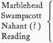
This Scale Containeth Eighty English Miles [along scale at top center]
To The | Honourable Sr: | WALTER YOUNGE | BARRONET one of the Commissioners for His | MAIESTIES Customs | This description of New ENGLAND in AMERICA | is most humbly dedicated & | presented by your HONOURS: | faithfull obedient Servant: | William Hack [in decorative cartouche of dedication at upper left]
Gulielmus Hack Delineavit [at lower right]